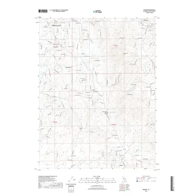
2018 Map of Bangor
USGS Topo · Published 2018About this map
Bangor and the surrounding foothill landscape of Butte County are defined by an intricate network of waterways and ravines that once supported the local mining and agricultural economy. The presence of Henderson Ditch, the Palermo Canal, and Bangor Ditch illustrates the historical importance of water management in this gold-country region. Settlement patterns appear concentrated near Wyandotte and Hurleton, while local genealogy is grounded at the Oak Grove Cem and Bangor Cem. The terrain is marked by notable elevations such as Phoenix Hill and Rattlesnake Point, which overlook a series of deep cuts including Wyman Ravine and French Ravine. The landscape's industrial character is further evidenced by names like Golddigger Ln and Fine Gold Gulch, hinting at the mineral history of the northern Central Valley foothills.
Find a feature on this map
138 named features on this map. Tap any name to fly to it.
Don’t see what you’re looking for? This feature index may not catch every label — zoom into the map to look around manually.
Map Details
Editions of this 2018 Bangor Map
This is the sole edition of this map. No revisions or reprints were ever made.
Other maps of this area

1888 · Marysville
USGS Topo · 1:125,000

1888 · Smartsville
USGS Topo · 1:125,000

1888 · Bidwell Bar
USGS Topo · 1:125,000

1891 · Bidwell Bar
USGS Topo · 1:125,000

1891 · Chico
USGS Topo · 1:125,000

1891 · Marysville
USGS Topo · 1:125,000

1891 · Smartsville
USGS Topo · 1:125,000

1892 · Smartsville
USGS Topo · 1:125,000

1893 · Chico
USGS Topo · 1:125,000

1893 · Bidwell Bar
USGS Topo · 1:125,000