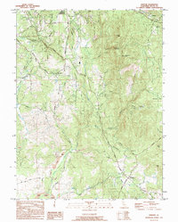
1994 Map of Bangor
USGS Topo · Published 1995About this map
North Honcut Creek and its many tributaries, such as French Ravine and Irish Ravine, define the complex drainage patterns of this Sierra Nevada foothills region. The landscape is heavily marked by its gold-mining history, with numerous prospects and tailings scattered throughout, particularly near Swedes Flat and south of Wyandotte. The presence of the Phoenix Mine (Abandoned) near Phoenix Hill further underscores the area's industrial legacy.
Find a feature on this map
60 named features on this map. Tap any name to fly to it.
Don’t see what you’re looking for? This feature index may not catch every label — zoom into the map to look around manually.
Map Details
Editions of this 1994 Bangor Map
This is the sole edition of this map. No revisions or reprints were ever made.
Other maps of this area

1888 · Marysville
USGS Topo · 1:125,000

1888 · Smartsville
USGS Topo · 1:125,000

1888 · Bidwell Bar
USGS Topo · 1:125,000

1891 · Bidwell Bar
USGS Topo · 1:125,000

1891 · Chico
USGS Topo · 1:125,000

1891 · Marysville
USGS Topo · 1:125,000

1891 · Smartsville
USGS Topo · 1:125,000

1892 · Smartsville
USGS Topo · 1:125,000

1893 · Chico
USGS Topo · 1:125,000

1893 · Bidwell Bar
USGS Topo · 1:125,000