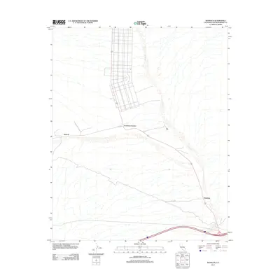
2012 Map of Bannock
USGS Topo · Published 2012About this map
Arrowhead Junction serves as a focal point for this desert landscape, where a planned grid of roads meets the historical travel routes of the Mojave. The intersection of Goffs Rd and several primitive trails underscores the area's importance as a transit corridor between the mountains and the Colorado River valley. Small settlements such as Bannock, Ibis, and Klinefelter are positioned along the primary rail and road artery, highlighting the sparse but strategic human footprint in this arid region. The drainage patterns are defined by the broad Piute Wash and Grestline Wash, which channel seasonal runoff through the alluvial fans. This mapping illustrates the persistent infrastructure of remote California, connecting isolated points through routes like the Homer-Klinefelter Rd and E Piute Valley Ac Rd.
Find a feature on this map
9 named features on this map. Tap any name to fly to it.
Don’t see what you’re looking for? This feature index may not catch every label — zoom into the map to look around manually.
Map Details
Editions of this 2012 Bannock Map
This is the sole edition of this map. No revisions or reprints were ever made.
Other maps of this area

1886 · Camp Mohave
USGS Topo · 1:250,000

1892 · Camp Mohave
USGS Topo · 1:250,000

1903 · Needles
USGS Topo · 1:125,000

1904 · Needles Special
USGS Topo · 1:125,000

1926 · Mohave City
USGS Topo · 1:96,000

1942 · Camp Mohave
USGS Topo · 1:250,000

1943 · Bannock
USGS Topo · 1:62,500

1947 · Kingman
USGS Topo · 1:250,000

1948 · Kingman
USGS Topo · 1:250,000

1950 · Davis Dam
USGS Topo · 1:62,500