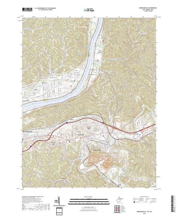
2023 Map of Barboursville
USGS Topo · Published 2023About this map
The Ohio River flows through this 2023 survey, separating Proctorville and Rome, Ohio, from the West Virginia riverfront at Lesage and Cox Landing. The landscape is defined by the winding Guyandotte River and the prominent ridges of Pea Ridge, which stretch between Huntington and Barboursville. This modern topographical study captures the extensive suburban development and transportation network of the Huntington metropolitan area, including the busy CSX Transportation corridor and the Midland Trl.
Find a feature on this map
131 named features on this map. Tap any name to fly to it.
Don’t see what you’re looking for? This feature index may not catch every label — zoom into the map to look around manually.
Map Details
Editions of this 2023 Barboursville Map
This is the sole edition of this map. No revisions or reprints were ever made.
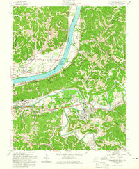
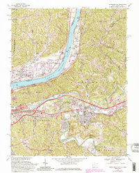
Historical Maps of Timberlake Through Time
3 maps found