2022 Map of Barnsdall
USGS Topo · Published 2022About this map
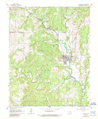
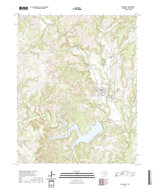
Barnsdall serves as the primary hub in this portion of Osage County, situated at the junction of several local routes such as Co RD 2400 and Co RD 2407. The town is surrounded by a high concentration of burial sites, including the James Bigheart Cem and Barnsdall City Cem, reflecting the deep familial roots of the community. To the northwest, the small settlement of Tallant sits along the banks of Bird Creek, while the southern reaches of the map are defined by the expansive waters of the Birch Creek arm and nearby impoundments like 113071 Reservoir. The terrain is deeply etched by a network of drainage systems, from Red Eagle Br to the winding Dog Thresher Creek, illustrating the complex hydrology that feeds into the regional reservoirs.
Find a feature on this map
68 named features on this map. Tap any name to fly to it.
Don’t see what you’re looking for? This feature index may not catch every label — zoom into the map to look around manually.
Map Details
Editions of this 2022 Barnsdall Map
This is the sole edition of this map. No revisions or reprints were ever made.