Old Maps of Oklahoma
Explore 8,056 old maps of Oklahoma, spanning from 1879 to today. These high-resolution historic maps reveal how streets, neighborhoods, landmarks, and natural features evolved over time — perfect for genealogy, metal detecting, research, and local history exploration.
What you can do with these maps:
- See how Oklahoma changed over time: Compare historical maps to modern-day views to trace roads, homesites, rail lines & more.
- View detailed metadata: Each map includes creators, publishers, year, scale, and archive source.
- Overlay maps with satellite & LiDAR: Visualize the past alongside modern tools to explore terrain & human change.
- Trusted historical sources: Maps sourced from the USGS, Library of Congress, and other archives.
- Access maps your way: View online, download high-res files, or order prints for personal or research use.
Start exploring old maps of Oklahoma to uncover forgotten places, hidden landmarks, and the deep history beneath your feet.
Oklahoma maps
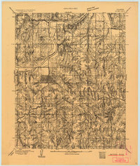
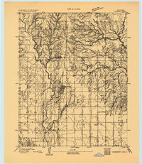
(8,056)- 1879 Map of Fort Smith
 1879 Fort Smith1879 Print · USGSFort Smith and Van Buren stand at the edge of the frontier in the late eighteen-seventies, just as the railroads began to reshape the Arkansas River valley. Trace the early town plats and find rural community anchors like Zenobia P.O., Lillie, and the Ferry crossings.
 - 1887 Map of Van Buren
 1887 Van Buren1887 Print · USGSThe Arkansas frontier meets the Indian Territory in the late nineteenth century, centered on the growing river hubs of Fort Smith and Van Buren. Genealogists and researchers can locate old post offices like Cavanaugh P.O. and trace the early routes of the Ft. Smith & Southern R. R.
 - 1887 Map of Poteau Mountain #2
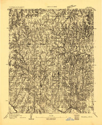
 1887 Poteau Mountain #21887 Print · USGSWestern Arkansas in the late nineteenth century was a land of high ridges and isolated river valleys. You can trace the early footprints of Scott County through settlements like Cauthron and Gipson or follow the waters of the Poteau River.
 - 1887 Map of Greenwood
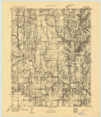
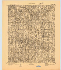
 1887 Greenwood1887 Print · USGSSebastian County was undergoing a period of rapid development in the 1880s as the rail network expanded through its ridge-and-valley terrain. Genealogists can trace the early layouts of Greenwood and Hackett City or find family sites near Jenny Lind and Sugar Loaf Mountain.
 - 1890 Map of Fort Smith
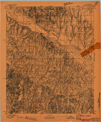
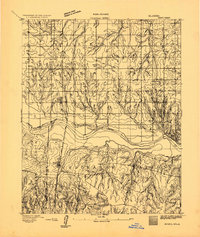
 1890 Fort Smith1890 Print · USGSThe Arkansas-Indian Territory border was a landscape of rapid transition in the late nineteenth century. Genealogists and historians can trace early post offices like Jenny Lind P.O. and Oak Bower (Lavaca P.O.) or follow the path of the St. Louis and San Francisco Railroad.7 unique versions available
 - 1890 Map of Poteau Mountain
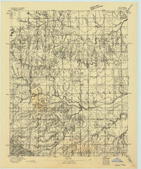
 1890 Poteau Mountain1890 Print · USGSWestern Arkansas and the Indian Territory border are mapped in the late 1880s as the frontier gives way to established settlements. Genealogists can trace early homesteads and post offices like Waldron, Dallas, and Cherry Hill, or locate the historic Toll Gate and Talihina Trail.2 unique versions available
 - 1891 Map of Springfield
 1891 Springfield1891 Print · USGSSoutheastern Colorado is captured in the late frontier era just after the county's founding. Researchers can trace the early layout of Springfield and its relationship to the seasonal waters of Sand Arroyo and Bear Creek.
 - 1892 Map of Meade
 1892 Meade1892 Print · USGSSouthwestern Kansas at the end of the nineteenth century centers on the growing rail hub of Meade. Genealogists and historians can trace early prairie settlements and rail stops like Fowler, Minneola, and the riverside site of Odee.5 unique versions available
 - 1892 Map of Moore
 1892 Moore1892 Print · USGSOklahoma Territory was still in its infancy when this survey was conducted, showing the vital rail line connecting early settlements. Genealogists and historians can trace the foundations of Moore and find long-forgotten locations like Chaddick and Berry along the Atchison Topeka and Santa Fe Rail Road.
 - 1892 Map of Guthrie
 1892 Guthrie1892 Print · USGSGuthrie and the surrounding Logan County landscape are captured here in the early years of the Oklahoma Territory. Researchers can trace the vital Atchison Topeka and Santa Fe RR line and find early settlements like Lowrie and Beulah.
 - 1892 Map of Mt Carrizo
 1892 Mt Carrizo1892 Print · USGSSoutheastern Colorado in the early 1890s remained a landscape of high mesas and vital water holes. Historians can trace the original topography of Las Animas and Baca counties, locating critical sites like Carrizo Springs and Willow Spring.7 unique versions available
 - 1892 Map of Coldwater
 1892 Coldwater1892 Print · USGSComanche County during the late nineteenth-century settlement boom shows a network of emerging prairie towns and cattle-shipping rail lines. Genealogists can trace early homestead locations near Coldwater, Nescatunga, and along the banks of Mule Creek.5 unique versions available
 - 1892 Map of Edmond
 1892 Edmond1892 Print · USGSOklahoma Territory was still in its first years of settlement when this survey was conducted, showing the vital rail corridor through Edmond. Researchers can trace early township boundaries and the paths of the Atchison Topeka and Santa Fe Railroad near Waterloo and Enfield.
 - 1892 Map of Kingfisher, 1957 Print
 1892 Kingfisher1957 Print · USGSOklahoma Territory was in a state of rapid transition during the 1890s as railroads and cattle trails shared the same landscape. Researchers can trace the original Chisholm Trail alongside early settlements like Mathewson and river crossings such as Kirby Ford.
 - 1893 Map of Norman
 1893 Norman1893 Print · USGSOklahoma Territory and Indian Territory meet along the river in the late nineteenth century. Trace the early footprints of Norman, Noble, and Purcell along the Atchison Topeka and Santa Fe R. R. and the winding Canadian River.2 unique versions available
 - 1893 Map of Fort Reno
 1893 Fort Reno1893 Print · USGSCentral Oklahoma's frontier landscape is documented here in the final decade of the nineteenth century. Genealogists and historians can locate the Darlington Agency, the early enclave of African City, and the military post at Fort Reno.2 unique versions available
 - 1893 Map of Mulhall
 1893 Mulhall1893 Print · USGSCentral Oklahoma land was newly opened for settlement when these surveyors documented the prairie around Mulhall and Orlando. Genealogists and local historians can trace the early township grids near Clarkson and along the winding Cimarron River.
 - 1893 Map of Oklahoma City
 1893 Oklahoma City1893 Print · USGSOklahoma City and the surrounding territory are captured here in the 1890s, just as the rail lines began transforming the landscape. You can trace early township developments and find the historic border between the Oklahoma territory and the Chickasaw Nation near Walden and Clancy.
 - 1893 Map of Lovell
 1893 Lovell1893 Print · USGSOklahoma Territory was still in its infancy when this survey was conducted, showing the land just after the first settlers arrived. Genealogists can trace the early locations of Marshall, Sheridan, and Columbia along the banks of Skeleton Creek.
 - 1893 Map of Buggy Creek
 1893 Buggy Creek1893 Print · USGSOklahoma Territory near the turn of the century reveals a landscape defined by the Wichita Reservation and frontier outposts. Genealogists and historians can trace early activity at the Indian Village and Stage Stand along the Canadian River.2 unique versions available
 - 1893 Map of Springfield
 1893 Springfield1893 Print · USGSSoutheast Colorado at the end of the frontier era centers on the early development of Springfield and the ranching lands of Baca County. Genealogists and historians can trace the original wagon road networks and early border geography along the Colorado Oklahoma Boundary Line and Red Cañon.4 unique versions available
 - 1893 Map of Hennessey
 1893 Hennessey1893 Print · USGSOklahoma Territory is captured during its formative years of settlement as the iron rail connects the prairie to the wider world. Genealogists and historians can trace the early foundations of Hennessey or locate smaller, early outposts like Buffalo Springs, Paris, and Myrtle.
 - 1893 Map of Minco
 1893 Minco1893 Print · USGSIndian Territory and the Chickasaw Nation lands meet at the turn of the century along the Canadian River. Genealogists can trace early homesteading patterns near Minco and along the Chicago Rock Island and Pacific Rail Road.
 - 1893 Map of Stillwater
 1893 Stillwater1893 Print · USGSOklahoma Territory was still in its formative years when this survey of the Stillwater area was completed. Genealogists and historians can trace the early township grid and locate pioneer settlements like Marena, Brinton, and the springs at Elm Spring.
 - 1893 Map of Loyal
 1893 Loyal1893 Print · USGSOklahoma Territory was still in its first decade of settlement when these early communities began to dot the landscape. Researchers can trace the original locations of Omega, Alpha, and Huntsville alongside the borders of the Cheyenne and Arapahoe Reservation.2 unique versions available
Showing maps 1-25 of 8,056
Top cities of Oklahoma
- Oklahoma City historical maps
- Tulsa historical maps
- Norman historical maps
- Broken Arrow historical maps
- Lawton historical maps
- Edmond historical maps
See more
Top counties of Oklahoma
- Oklahoma County historical maps
- Cleveland County historical maps
- Canadian County historical maps
- Comanche County historical maps
- Rogers County historical maps
- Payne County historical maps
See more
Frequently asked questions
- What are the different types of historical maps available for Oklahoma?
- What is the oldest map of Oklahoma?
- Where can I purchase historical maps of Oklahoma for my home or office?
- Where can I download high-res historical maps of Oklahoma?
- Are there historical topographic maps available for Oklahoma?
- Is there historical aerial imagery available for Oklahoma?
- Where are historical maps of Oklahoma sourced from?