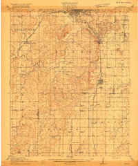
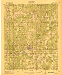
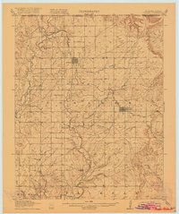
1910s Maps of Oklahoma
Explore 24 historic maps of Oklahoma from the 1910s. These maps offer a rare glimpse into what life looked like during the 1910s — showing old roads, neighborhoods, homes, and landmarks that have changed or disappeared over time.
Whether you're researching your family's past, planning a metal detecting trip, or studying how Oklahoma's landscape evolved across the 1910s, these high-resolution maps are a powerful tool for exploring the history of this region.
- Focus on a specific era: All maps on this page are from the 1910s, giving you a focused view of this time period.
- See what’s changed: Compare century-old streets, trails, and buildings to today's modern landscape using overlays and satellite layers.
- Research with precision: Use these maps for genealogy, historical research, land use analysis, or educational projects.
- View, download, or print: Maps are fully viewable online in high resolution, and can be downloaded or printed for your own records.
Start exploring Oklahoma's history through authentic maps from the 1910s. This is your window into the past.
Oklahoma maps
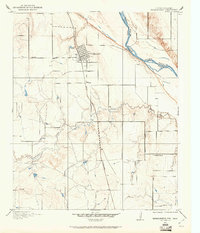
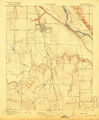
(24)- 1910 Map of McComb
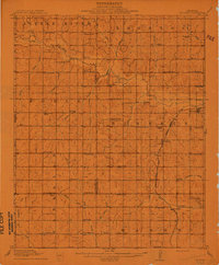 1910 McComb1910 Print · USGSPottawatomie County was still transitioning from territorial days when this survey recorded its burgeoning rail towns and rural school districts. Researchers can find early landmarks like Solomons Temple School and Tribbey, or trace the path of the AT&SF RR through the local landscape.2 unique versions available
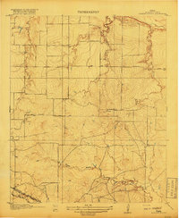
 - 1910 Map of Pawhuska
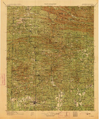
 1910 Pawhuska1910 Print · USGSOsage County's landscape at the dawn of Oklahoma statehood reveals a transition from tribal lands to a rail-connected economy. Genealogists and historians can trace early settlements like Wynona and Bigheart, or find local landmarks like Daltons Caves and White Swan Ford.2 unique versions available
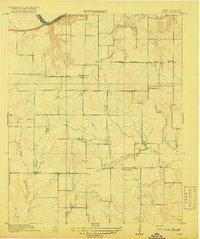
 - 1911 Map of Sallisaw
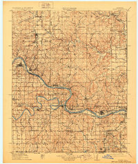
 1911 Sallisaw1911 Print · USGSEastern Oklahoma at the turn of the century was a land of expanding railroads and ancient river crossings along the Arkansas River. Genealogists and historians can trace the early settlement of the region through dozens of landmarks like Foreman Ferry, McCurtain, and the Badger Lee School.3 unique versions available
 - 1911 Map of Sansbois
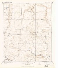
 1911 Sansbois1911 Print · USGSEastern Oklahoma's river valleys and rugged hills come alive in this early twentieth-century survey of the Choctaw Nation's western reaches. Researchers can locate rural landmarks like Sansbois Station, the Belle Starr School, and early river crossings such as the Thornton Ferry.3 unique versions available
 - 1912 Map of Antlers
 1912 Antlers1912 Print · USGSSoutheastern Oklahoma’s river valleys and growing rail towns are captured here in the decade following statehood. Genealogists can trace family roots through numerous rural landmarks like Niles Store, the Asphalt Mine, and early school sites such as Timber Hill School.3 unique versions available
 - 1912 Map of Hominy, 1960 Print
 1912 Hominy1960 Print · USGSNortheastern Oklahoma comes alive in this pre-reservoir survey, documenting the river-valley settlements and tribal lands of the early statehood era. Genealogists can locate dozens of country schools and sites like Black Dog (Indian Village) or the early Oil City Barnsdall P O.
 - 1913 Map of Vinita
 1913 Vinita1913 Print · USGSNortheast Oklahoma at the height of its rail-and-ranch era is meticulously detailed here just as the state was entering its second decade. Genealogists can trace family roots through dozens of local landmarks like W H School, Big Cabin, and the Blue Hawk School.3 unique versions available
 - 1913 Map of De Queen
 1913 De Queen1913 Print · USGSThe southern Ouachita Mountains and the Arkansas-Oklahoma borderlands appear here in the early twentieth century as the railroad transformed the timber and mining industries. Researchers can trace historic sites like the Welcome Home School, the Kansas City Southern RR corridor, and the early streets of De Queen.4 unique versions available
 - 1914 Map of Kiefer
 1914 Kiefer1914 Print · USGSCreek and Tulsa Counties are seen here during the height of the early oil boom, centered on the rail junctions and tank farms. Researchers can trace the development of petroleum infrastructure near Glenpool or locate vanished country schools like Blackout Forest School and Locust Hill School.2 unique versions available
 - 1914 Map of Nowata
 1914 Nowata1914 Print · USGSNortheastern Oklahoma at the height of its early statehood growth is documented here as the railroad network expanded across the Verdigris River valley. Genealogists can locate dozens of country schools like Go-back School and vanished post offices such as Avelia Wayside PO.5 unique versions available
 - 1914 Map of Claremore, 1959 Print
 1914 Claremore1959 Print · USGSNortheastern Oklahoma was a landscape of river crossings and rail towns in the years just before the Great War. Genealogists and researchers can trace the locations of dozens of vanished rural schools like Elm Ridge School, river landmarks such as Thomas Ferry, and the early footprints of Broken Arrow and Tulsa.
 - 1915 Map of Hominy
 1915 Hominy1915 Print · USGSOsage and Creek counties come to life in the years before the Great War, showing a landscape defined by river confluences and the expansion of the rail industry. Genealogists can locate early settlements like Black Dog and schools like Dripping Spring School or Sunset School.2 unique versions available
 - 1915 Map of Hominy, 1928 Print
 1915 Hominy1928 Print · USGSNortheast Oklahoma during the early oil and rail boom is captured here as the Osage and Creek county lines meet the great river bends. Genealogists can trace early homesteads near Black Dog, Oil City, and Union Chapel.2 unique versions available
 - 1915 Map of Clara, 1961 Print
 1915 Clara1961 Print · USGSWichita County was a land of rural schoolhouses and river crossings during the early twentieth century. Researchers can trace the original locations of Fairview School, Wyeth School, and the settlement of Clara along the banks of the Red River.
 - 1915 Map of Barwise School, 1961 Print
 1915 Barwise School1961 Print · USGSWichita County was a landscape of remote school districts and winding prairie creeks during the early years of the twentieth century. Researchers can trace the rural infrastructure of the era through landmarks like Barwise School, the Fort Worth and Denver City rail line, and Tenth Cavalry Creek.
 - 1915 Map of Burkburnett, 1961 Print
 1915 Burkburnett1961 Print · USGSThe Texas-Oklahoma borderlands south of the Red River are shown here in the mid-1910s as rail and road networks began to reshape the frontier. Researchers can trace the early layout of Burkburnett, the location of the Cashion School, and the route of the Wichita Falls and Northwestern railroad.
 - 1916 Map of Kiefer
 1916 Kiefer1916 Print · USGSCreek County at the height of the early oil boom years is captured here in fine detail. Genealogists can trace the rural landscape through family-named schools like Crowson School, Bluebell School, and the Louisiana Baptist Church.3 unique versions available
 - 1916 Map of Claremore
 1916 Claremore1916 Print · USGSThe Verdigris River valley and the burgeoning rail hubs of Rogers and Tulsa counties are captured here just after Oklahoma statehood. Genealogists can locate family homesteads near dozens of early schools like Fair Valley School or early churches such as Greenwood Chapel.4 unique versions available
 - 1916 Map of Bristow
 1916 Bristow1916 Print · USGSBristow and its surrounding Creek County townships appear here during the early oil boom years of the mid-1910s. Researchers can locate dozens of country schools and unique landmarks like the Indian Dance Grounds and the industrial Oil Tank Farm.5 unique versions available
 - 1916 Map of Foraker
 1916 Foraker1916 Print · USGSNorthern Osage County is captured here just before the First World War, showing the ranching and rail landscape of the Oklahoma-Kansas border. Family historians can locate rural landmarks like Red Eagle School, Grainola, and the Midland Valley railroad.2 unique versions available
 - 1918 Map of Ardmore
 1918 Ardmore1918 Print · USGSSouthern Oklahoma was a hub of energy production and rail traffic during the late teens. Researchers can trace the early infrastructure of the Healdton Oil Fields, find vanished sites like Joiner City, or locate the Post Oak School.
 - 1918 Map of Buckburnett
 1918 Buckburnett1918 Print · USGSWichita County sits on the edge of a historic oil boom during the late nineteen-teens, dominated by the winding Red River border. Genealogists and historians can trace early town plats in Burkburnett, rural landmarks like Cashion School, and the path of the Wichita Falls and Northwestern railroad.3 unique versions available
 - 1918 Map of Barwise School
 1918 Barwise School1918 Print · USGSWichita County was a landscape of emerging rural school districts and early transit corridors during the First World War. Genealogists and historians can trace the early property lines and routes connecting Barwise School and Sunshine School with the Fort Worth and Denver City Road.2 unique versions available
 - 1918 Map of Clara
 1918 Clara1918 Print · USGSThe North Texas borderlands along the Red River appear here during the height of the early twentieth-century oil boom era. Researchers can locate the early rural settlements of Clara and Stringtown, alongside historic country schoolhouses like Wyeth School.2 unique versions available
End of results
Showing maps 1-24 of 24
Top cities of Oklahoma
- Oklahoma City historical maps
- Tulsa historical maps
- Norman historical maps
- Broken Arrow historical maps
- Lawton historical maps
- Edmond historical maps
See more
Top counties of Oklahoma
- Oklahoma County historical maps
- Cleveland County historical maps
- Canadian County historical maps
- Comanche County historical maps
- Rogers County historical maps
- Payne County historical maps
See more
Frequently asked questions
- What are the different types of historical maps available for Oklahoma?
- What is the oldest map of Oklahoma?
- Where can I purchase historical maps of Oklahoma for my home or office?
- Where can I download high-res historical maps of Oklahoma?
- Are there historical topographic maps available for Oklahoma?
- Is there historical aerial imagery available for Oklahoma?
- Where are historical maps of Oklahoma sourced from?