1960s Maps of Oklahoma
Explore 481 historic maps of Oklahoma from the 1960s. These maps offer a rare glimpse into what life looked like during the 1960s — showing old roads, neighborhoods, homes, and landmarks that have changed or disappeared over time.
Whether you're researching your family's past, planning a metal detecting trip, or studying how Oklahoma's landscape evolved across the 1960s, these high-resolution maps are a powerful tool for exploring the history of this region.
- Focus on a specific era: All maps on this page are from the 1960s, giving you a focused view of this time period.
- See what’s changed: Compare century-old streets, trails, and buildings to today's modern landscape using overlays and satellite layers.
- Research with precision: Use these maps for genealogy, historical research, land use analysis, or educational projects.
- View, download, or print: Maps are fully viewable online in high resolution, and can be downloaded or printed for your own records.
Start exploring Oklahoma's history through authentic maps from the 1960s. This is your window into the past.
Oklahoma maps
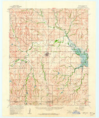
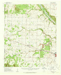
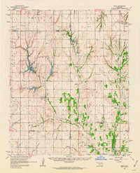
(481)- 1960 Map of Sweetwater, 1961 Print
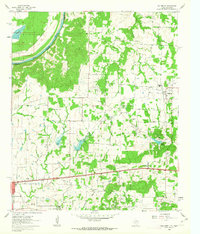
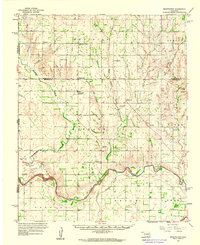 1960 Sweetwater1961 Print · USGSWestern Oklahoma ranching and farming life is detailed in the early sixties as it transitions across the Beckham and Roger Mills county lines. Genealogists can trace family footprints at Sweetwater High Sch and numerous burial sites like Brookside Cem and Mayfield Cem.2 unique versions available
 - 1960 Map of Cheyenne, 1961 Print
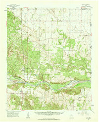
 1960 Cheyenne1961 Print · USGSRoger Mills County in the early sixties was a landscape defined by the winding Washita River and the critical corridor of the Panhandle and Santa Fe railroad. Genealogists and local historians can trace the foundations of the area through rural landmarks like Sandstone Sch, the town of Strong City, and the landing field at Cheyenne.3 unique versions available
 - 1960 Map of Nanos, 1961 Print
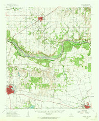
 1960 Nanos1961 Print · USGSOsage County in the early sixties is shown here as a landscape of rural industry and rail transport. Genealogists and historians can locate the Pappin Cem and trace the paths of Wild Hog Creek or the Atchison Topeka and Santa Fe line.2 unique versions available
 - 1960 Map of Sayre, 1961 Print
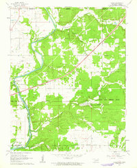
 1960 Sayre1961 Print · USGSWestern Oklahoma’s river valleys and rail lines are captured here at the dawn of the 1960s. Genealogists can locate rural landmarks such as Lone Oak Ch, the Sayre-Doxey Cem, and the community of Delhi.2 unique versions available
 - 1960 Map of Bethel, 1961 Print
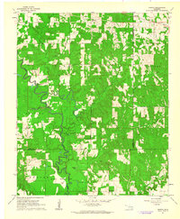
 1960 Bethel1961 Print · USGSMcCurtain County's timber-rich mountain country is captured here during the early sixties, showing the vital link between the land and the logging industry. Researchers can locate remote landmarks like Mt Zion Ch, trace the Industrial Railroad, and explore the rural settlements of Battiest and Sherwood.6 unique versions available
 - 1960 Map of Hammon, 1961 Print
 1960 Hammon1961 Print · USGSHammon and the surrounding High Plains communities are caught here at a mid-century peak of rail and river activity. Local researchers can trace the routes of the Missouri Kansas Texas railroad and locate rural landmarks like Thompson Cem and Moorewood.
 - 1960 Map of Nelagoney, 1961 Print
 1960 Nelagoney1961 Print · USGSThe Osage Hills at the start of the sixties were a landscape defined by petroleum production and quiet creek valleys. Local historians can trace the paths of the Missouri Kansas Texas railroad through Okesa and identify oil wells across Strike Axe.2 unique versions available
 - 1960 Map of Herd, 1961 Print
 1960 Herd1961 Print · USGSOsage County's industrial and recreational landscape is captured here in the early sixties as petroleum extraction and state park development shaped the hills. Genealogists and historians can trace the Atchison Topeka and Santa Fe rail line through Herd and Bigheart, and locate rural landmarks like Twin Mounds or the old Cem.4 unique versions available
 - 1960 Map of Smithville, 1961 Print
 1960 Smithville1961 Print · USGSMcCurtain County's forested uplands are captured here in the early sixties, showing a landscape defined by isolated mountain settlements and vast game preserves. Genealogists can locate family sites near Beechtree Cem, Nani-chito Cem, and the old community at Beachton.3 unique versions available
 - 1960 Map of Pawhuska, 1961 Print
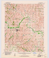
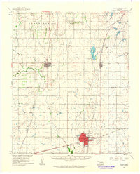
 1960 Pawhuska1961 Print · USGSThe Osage County seat comes alive in the early sixties, showing a community built on a foundation of oil and ranching. Genealogists and historians can trace rail lines like the Midland Valley or locate local landmarks including Indian Camp Sch and Lookout Cem.3 unique versions available
 - 1960 Map of Goodlett, 1962 Print
 1960 Goodlett1962 Print · USGSHardeman County at the dawn of the 1960s was a landscape defined by the Red River and a busy network of converging rail lines. Researchers can trace the layouts of small communities like Goodlett and Punkin Center or locate rural burial grounds including Elba Cem and Johnson Cem.2 unique versions available
 - 1960 Map of Loco, 1962 Print
 1960 Loco1962 Print · USGSChildress and Collingsworth counties are captured here in the early sixties, as the cattle and cotton country straddles the Oklahoma border. Researchers can trace rural lineages through the Loco Cem, find former school sites like Garden Valley Sch, or follow the Fort Worth and Denver rail line.
 - 1960 Map of Quanah, 1963 Print
 1960 Quanah1963 Print · USGSThe Red River frontier comes to life in the early sixties, showing the vital rail-and-river connection between Oklahoma and the Texas Panhandle. Researchers can trace family roots through Eldorado Cem, King Sch, and the rail lines serving Quanah and Chillicothe.3 unique versions available
 - 1960 Map of Peoria, 1963 Print
 1960 Peoria1963 Print · USGSThe Oklahoma-Kansas borderlands in the early sixties reveal a complex landscape of tribal reservations and industrial mining. Genealogists and historians can trace family locations near the Peoria Cem, local schools like Elgin Sch, and numerous Tripoli Mines.2 unique versions available
 - 1960 Map of Callisburg, 1963 Print
 1960 Callisburg1963 Print · USGSCooke County and the Oklahoma border are documented here in the early sixties as the regional oil industry thrived. Researchers can locate family landmarks like Center Hill Cem, the Gainesville State School For Girls, and the extensive Walnut Bend Oil Field.2 unique versions available
 - 1960 Map of Gainesville North, 1964 Print
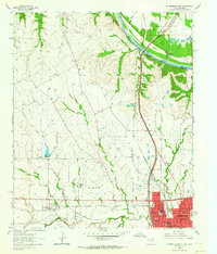 1960 Gainesville North1964 Print · USGSGainesville and the surrounding Texas-Oklahoma borderlands are captured here in the early sixties as the regional rail and air infrastructure expanded. Trace local family roots at Rest Haven Memorial Cemetery or explore the rail junction of the Missouri Kansas Texas and Gulf Colorado and Santa Fe lines.2 unique versions available
 - 1961 Map of Gotebo, 1962 Print
 1961 Gotebo1962 Print · USGSKiowa and Washita County homesteads are mapped here in the early sixties, anchored by the rail corridor of the Chicago Rock Island and Pacific. Researchers can locate several rural landmarks including the Rainy Mountain Indian Mission Cemetery, Lone Wolf Chapel, and the Old Indian Boundary.2 unique versions available
 - 1961 Map of Miami SE, 1962 Print
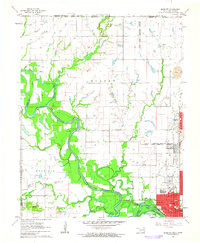
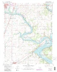 1961 Miami SE1962 Print · USGSNortheastern Oklahoma at the turn of the sixties shows a landscape shaped by tribal boundaries and the waters of the Lake of the Cherokees. Trace family roots at Bland Cem or locate former schools like McKinley Sch.4 unique versions available
 - 1961 Map of Eakly, 1962 Print
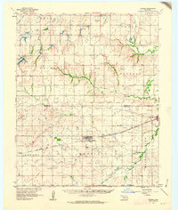
 1961 Eakly1962 Print · USGSSettlement and farming patterns in central Oklahoma are captured here in the early sixties, just as the Fort Cobb Reservoir began to transform the local drainage. Genealogists and historians can locate numerous rural burial grounds and meeting houses, including Missouri Cem Ch, High Point Cem, and the Indian Cem.2 unique versions available
 - 1961 Map of Hobart, 1962 Print
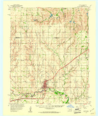
 1961 Hobart1962 Print · USGSKiowa and Washita counties are shown here in the early 1960s as a bustling junction of major rail lines and rural agricultural life. Researchers can trace family history through sites like Huckaby Cem, Sentinel High Sch, and the Oil Field.2 unique versions available
 - 1961 Map of Miami NW, 1963 Print
 1961 Miami NW1963 Print · USGSNortheastern Oklahoma at the start of the 1960s shows a landscape defined by tribal heritage and the legacy of the Tri-State mining district. Genealogists and historians can trace Old Indian Cem and North Fairview Sch alongside the active tracks of the St Louis-San Francisco RR.2 unique versions available
 - 1961 Map of Darwin, 1963 Print
 1961 Darwin1963 Print · USGSSoutheastern Oklahoma’s river bottoms and timberlands are captured here in the early sixties as small farming communities thrived. Local researchers can map the grounds of the Mc Leod Honor Farm or find family roots near Darwin Ch and Old Farris.2 unique versions available
 - 1961 Map of Antlers East, 1963 Print
 1961 Antlers East1963 Print · USGSAntlers and the rural southeast Oklahoma countryside are captured here in the early sixties, showing the area's transition from town to timberland. Genealogists and local historians can trace family locations near Hamden, Dela, and the Odd Fellows Cem.2 unique versions available
 - 1961 Map of Carnegie, 1963 Print
 1961 Carnegie1963 Print · USGSThe Washita River valley in the early sixties serves as the focal point for this survey of Carnegie and Mountain View. Genealogists can trace family names at Indian Mission, Cedar Creek Cem, or the Old Indian Treaty Boundary.
 - 1961 Map of Antlers West, 1963 Print
 1961 Antlers West1963 Print · USGSPushmataha County is captured here in the early sixties, showing the rural landscape around the town of Antlers. Genealogists and historians can trace local landmarks like Edwards Cem or follow the ST LOUIS SAN FRANCISCO rail line.2 unique versions available
Showing maps 1-25 of 481
Top cities of Oklahoma
- Oklahoma City historical maps
- Tulsa historical maps
- Norman historical maps
- Broken Arrow historical maps
- Lawton historical maps
- Edmond historical maps
See more
Top counties of Oklahoma
- Oklahoma County historical maps
- Cleveland County historical maps
- Canadian County historical maps
- Comanche County historical maps
- Rogers County historical maps
- Payne County historical maps
See more
Frequently asked questions
- What are the different types of historical maps available for Oklahoma?
- What is the oldest map of Oklahoma?
- Where can I purchase historical maps of Oklahoma for my home or office?
- Where can I download high-res historical maps of Oklahoma?
- Are there historical topographic maps available for Oklahoma?
- Is there historical aerial imagery available for Oklahoma?
- Where are historical maps of Oklahoma sourced from?