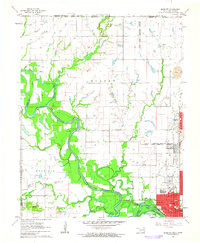
1961 Map of Miami NW
USGS Topo · Published 1963About this map
The Neosho River meanders through this portion of northeastern Oklahoma, defining a landscape of complex tribal boundaries and early industrial activity. The map clearly delineates the Quapaw Indian Res Bdy and the Peoria Indian Reservation Boundary, reflecting the area's significance in tribal history. To the south, the city of Miami is shown alongside the St Louis-San Francisco RR and the Will Rogers Turnpike, illustrating the region's mid-century transportation development.
Find a feature on this map
41 named features on this map. Tap any name to fly to it.
Don’t see what you’re looking for? This feature index may not catch every label — zoom into the map to look around manually.
Map Details
Editions of this 1961 Miami NW Map
2 editions found
Other maps of this area

1886 · Joplin
USGS Topo · 1:125,000

1886 · Parsons
USGS Topo · 1:125,000

1893 · Parsons
USGS Topo · 1:125,000

1894 · Joplin
USGS Topo · 1:125,000

1901 · Vinita
USGS Topo · 1:125,000

1907 · Wyandotte
USGS Topo · 1:125,000

1909 · Wyandotte
USGS Topo · 1:125,000

1913 · Vinita
USGS Topo · 1:125,000

1918 · Columbus
USGS Topo · 1:62,500

1944 · Oswego
USGS Topo · 1:62,500