
1961 Map of Antlers West
USGS Topo · Published 1963About this map
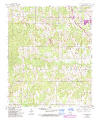
The town of Antlers serves as the primary hub in this early 1960s survey of southern Oklahoma, situated where the St Louis San Francisco railroad cuts through the northeastern corner of the quadrangle. The landscape is defined by an intricate network of waterways draining toward the Red River basin, including the uniquely named Dumpling Creek, Charlie Dumpling Creek, and the swampy lowlands of Lamey Slash. This era of documentation reveals a rural community supported by a local Landing Strip and a series of scattered spiritual and memorial sites, such as Sugarloaf Ch, Pierce Ch, and the Edwards Cem. The map provides a precise look at the jurisdictional boundary between PushmaтAha Co and Choctaw Co, following the natural contours of the terrain as it transitions south toward the Texas border.
Find a feature on this map
18 named features on this map. Tap any name to fly to it.
Don’t see what you’re looking for? This feature index may not catch every label — zoom into the map to look around manually.
Map Details
Editions of this 1961 Antlers West Map
2 editions found
Other maps of this area

1901 · Antlers
USGS Topo · 1:125,000

1912 · Antlers
USGS Topo · 1:125,000

1925 · Antlers
USGS Topo · 1:125,000

1950 · Mcalester
USGS Topo · 1:250,000

1957 · Farris
USGS Topo · 1:24,000

1957 · Moyers
USGS Topo · 1:24,000
1961 · Darwin
USGS Topo · 1:24,000

1961 · Antlers East
USGS Topo · 1:24,000

1962 · McAlester
USGS Topo · 1:250,000

1965 · McAlester
USGS Topo · 1:250,000