
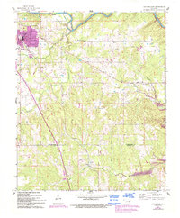
1961 Map of Antlers East
USGS Topo · Published 1963About this map
Antlers serves as the regional hub in this 1961 aerial survey, situated just north of the St Louis San Francisco railroad line. The landscape is characterized by the winding path of the Kiamichi River to the north and a network of creeks including Beaver Creek, Dumpling Creek, and One Creek that cut through the undulating terrain of the Jeter and Ratliffe districts.
Find a feature on this map
27 named features on this map. Tap any name to fly to it.
Don’t see what you’re looking for? This feature index may not catch every label — zoom into the map to look around manually.
Map Details
Editions of this 1961 Antlers East Map
2 editions found
Other maps of this area

1901 · Antlers
USGS Topo · 1:125,000

1901 · Alikchi
USGS Topo · 1:125,000

1912 · Antlers
USGS Topo · 1:125,000

1925 · Antlers
USGS Topo · 1:125,000

1950 · Mcalester
USGS Topo · 1:250,000

1957 · Moyers
USGS Topo · 1:24,000

1961 · Antlers West
USGS Topo · 1:24,000

1962 · McAlester
USGS Topo · 1:250,000

1965 · McAlester
USGS Topo · 1:250,000
1968 · Soper
USGS Topo · 1:24,000