
Loading...
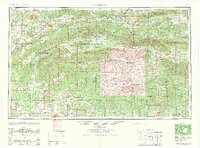
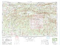
Loading map...1965 Map of McAlester
USGS Topo · Published 1965About this map
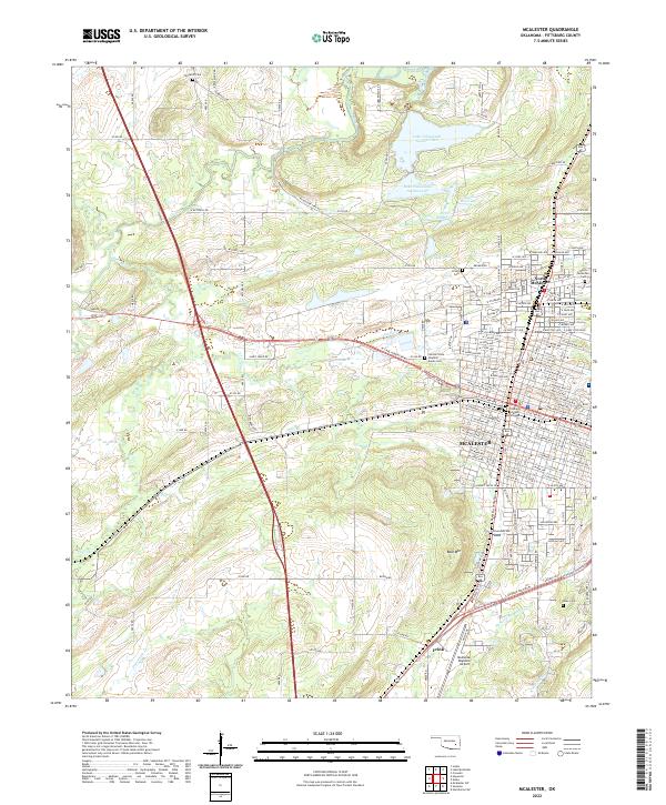
The Kiamichi Mountains and the Ouachita National Forest dominate this mid-century topographic perspective of southeastern Oklahoma and western Arkansas. Centered on the city of McAlester, the map illustrates a complex network of transportation and river systems before later 20th-century developments fully altered the landscape. Significant rail infrastructure is documented, including the Missouri-Kansas-Texas RR and the Chicago Rock Island & Pacific RR, which served the region's timber and mining interests.
Find a feature on this map
127 named features on this map. Tap any name to fly to it.
Don’t see what you’re looking for? This feature index may not catch every label — zoom into the map to look around manually.
Map Details
Date Portrayed1965
Date Published1965
PublisherU.S. Geological Survey
Map TypeTopographic
Scale1:250,000
Physical Dimensions32.6 x 24.7 inches
Editions of this 1965 McAlester Map
3 editions found
Historical Maps of McAlester Through Time
7 maps found

Featured Locations
Source Details
SourceU.S. Geological Survey
CopyrightPublic Domain