Old Maps of Pittsburg County, Oklahoma
Explore 241 old maps of Pittsburg County, spanning from 1896 to today. These high-resolution historic maps reveal how streets, neighborhoods, landmarks, and natural features evolved over time — perfect for genealogy, metal detecting, research, and local history exploration.
What you can do with these maps:
- See how Pittsburg County changed over time: Compare historical maps to modern-day views to trace roads, homesites, rail lines & more.
- View detailed metadata: Each map includes creators, publishers, year, scale, and archive source.
- Overlay maps with satellite & LiDAR: Visualize the past alongside modern tools to explore terrain & human change.
- Trusted historical sources: Maps sourced from the USGS, Library of Congress, and other archives.
- Access maps your way: View online, download high-res files, or order prints for personal or research use.
Start exploring old maps of Pittsburg County to uncover forgotten places, hidden landmarks, and the deep history beneath your feet.
Pittsburg County, OK maps
(241)- 1896 Map of Coalgate, 1957 Print
 1896 Coalgate1957 Print · USGSIndian Territory in the mid-1890s shows a landscape of tribal boundaries and nascent rail towns just before the turn of the century. Genealogists and historians can trace the early foundations of Coalgate and Calvin or locate family-named features along Muddy Boggy Creek.
 - 1898 Map of McAlester
 1898 McAlester1898 Print · USGSThe Choctaw Nation in the late 1890s was a landscape defined by emerging coal towns and critical rail junctions. Researchers can trace early settlements and industrial sites like South Mc Alester, Hartshorne, and Mine No. 5 along the Choctaw Oklahoma and Gulf R. R.4 unique versions available
 - 1899 Map of Coalgate
 1899 Coalgate1899 Print · USGSIndian Territory at the close of the nineteenth century is captured here as the coal industry transformed the landscape. Genealogists can trace family roots in the Seminole Nation or search for early mining-era homesites in Coalgate and Phillips.
 - 1900 Map of Sansbois
 1900 Sansbois1900 Print · USGSIndian Territory in the late nineteenth century is documented here through its tribal boundaries and early river settlements. Genealogists can trace family roots near Stigler, Porum, and Whitefield, or locate the isolated station at Sandtown along the St L & S F R R.2 unique versions available
 - 1900 Map of Canadian
 1900 Canadian1900 Print · USGSIndian Territory at the turn of the century shows a landscape of tribal nations and developing rail towns along the CANADIAN RIVER. Genealogists and historians can trace early settlements like Fishertown and Indianola or the original Creek Nation Choctaw Nation Boundary Line.6 unique versions available
 - 1900 Map of Wewoka
 1900 Wewoka1900 Print · USGSIndian Territory at the turn of the century shows a landscape defined by tribal nations and the early expansion of the railway. Genealogists can trace family homesteads near Wewoka and Holdenville, or locate remote landmarks like Marks Store and the Baptist Mission.4 unique versions available
 - 1900 Map of Coalgate
 1900 Coalgate1900 Print · USGSIndian Territory at the turn of the century shows a land of tribal boundaries and emerging coal towns. Researchers can trace the early rail corridors of the M. K. and T. R. R. and locate vanished communities like Guertie, Citra, and Legal.3 unique versions available
 - 1909 Map of Mc Alester
 1909 Mc Alester1909 Print · USGSSoutheast Oklahoma's coal mining belt and the rugged Choctaw Nation territory are captured here in the early years of statehood. Researchers can trace the rail-side growth of McAlester and Hartshorne or locate vanished sites like Barnett Sta Haywood PO and Perryville.3 unique versions available
 - 1909 Map of Sans Bois, 1954 Print
 1909 Sans Bois1954 Print · USGSHaskell and Muskogee counties are seen here in the decade following statehood, when rail lines and river crossings dictated the pulse of rural life. Genealogists can trace family roots through numerous local landmarks like Kanima P O, Belle Starr School, and the Sansbois Sta.
 - 1911 Map of Sansbois
 1911 Sansbois1911 Print · USGSEastern Oklahoma's river valleys and rugged hills come alive in this early twentieth-century survey of the Choctaw Nation's western reaches. Researchers can locate rural landmarks like Sansbois Station, the Belle Starr School, and early river crossings such as the Thornton Ferry.3 unique versions available
 - 1946 Map of Fort Smith
 1946 Fort Smith1946 Print · USGSThe Arkansas-Oklahoma borderlands appear here in the mid-forties, as new reservoirs began to transform the river valleys. Genealogists and historians can trace rail-served towns from Muskogee to Fort Smith and locate landmarks like Camp Chaffee.
 - 1950 Map of Mcalester
 1950 Mcalester1950 Print · USGSThe Ouachita Mountains and the coal country of Southeast Oklahoma are shown here in the late 1940s. Genealogists and historians can trace the rail-driven growth of McAlester, Wilburton, and Antlers alongside the rugged terrain of Kiamichi Mountain.2 unique versions available
 - 1954 Map of Oklahoma City
 1954 Oklahoma City1954 Print · USGSOklahoma City and its surrounding counties are captured here in the early fifties during a period of significant postwar growth. Researchers can trace the development of the Turner Turnpike and locate aviation hubs like Tinker Field or Will Rogers Field.
 - 1957 Map of Limestone Gap, 1958 Print
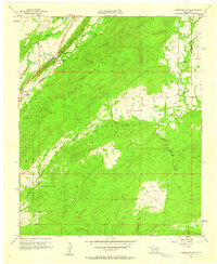 1957 Limestone Gap1958 Print · USGSAtoka County during the late fifties reveals a landscape defined by the ridgelines of the Choctaw Nation. Genealogists and historians can trace the old rail corridor of the Missouri Kansas Texas through settlements like Chockie, Burg, and Limestone Gap.2 unique versions available
 - 1957 Map of Ardmore, 1968 Print
 1957 Ardmore1968 Print · USGSSouth-central Oklahoma in the late fifties was a landscape of rising reservoir waters and expanding rail lines. Genealogists and historians can trace the foundations of Ardmore and Duncan or locate early recreation sites at Platt National Park and Lake Murray State Park.3 unique versions available
 - 1957 Map of Oklahoma City, 1969 Print
 1957 Oklahoma City1969 Print · USGSCentral Oklahoma is captured here in a period of significant mid-century growth and industrialization. Researchers can trace family roots through numerous rural markers like Memory Lane Cem, New Hope School, and the sprawling grounds of Tinker Air Force Base.3 unique versions available
 - 1962 Map of McAlester
 1962 McAlester1962 Print · USGSSoutheastern Oklahoma and western Arkansas are shown here during the early sixties, a time of transition for the region's mountain communities and timberlands. Researchers can trace the paths of the Kansas City Southern RR through Heavener or locate settlements like Talihina and Broken Bow near the Kiamichi Mountains.2 unique versions available
 - 1963 Map of Ardmore
 1963 Ardmore1963 Print · USGSSouthern Oklahoma during the early sixties shows a landscape defined by the Arbuckle Mountains and a booming energy economy. Genealogists and historians can trace family-named sites across the Ardmore Oil Field, find old schools like Southeastern State College, or locate historic markers such as Boggy Depot State Park.2 unique versions available
 - 1963 Map of Oklahoma City
 1963 Oklahoma City1963 Print · USGSCentral Oklahoma in the early sixties showcases a landscape of rapid suburban growth and established oil production. Researchers can trace historic rail lines like the Chicago Rock Island and Pacific RR or locate rural landmarks such as Mayflower School and Bethel Church.
 - 1963 Map of Eufaula, 1964 Print
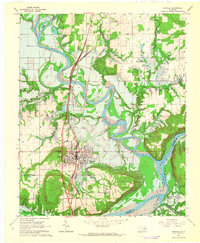 1963 Eufaula1964 Print · USGSThe McIntosh County seat is shown here in the early sixties during the creation of its namesake reservoir. Researchers can trace the original riverbanks before the flooding of the Eufaula Reservoir and locate local landmarks like West Eufaula Ch and McIntosh Cem.3 unique versions available
 - 1963 Map of Texanna, 1964 Print
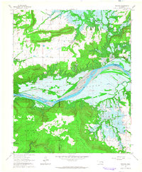 1963 Texanna1964 Print · USGSOklahoma's river valleys were undergoing a massive transformation in the early sixties as the reservoir began to fill. Researchers can trace land tracts near the Old Indian Treaty Boundary or find family sites like Lindsey Chapel and Triplett Cem.3 unique versions available
 - 1965 Map of Fort Smith
 1965 Fort Smith1965 Print · USGSEastern Oklahoma and Western Arkansas are captured here during a period of massive post-war change as new reservoirs reshaped the river valleys. Genealogists and historians can trace the rail networks of the Midland Valley RR and find established communities like Stilwell, Sallisaw, and Stigler.
 - 1965 Map of McAlester
 1965 McAlester1965 Print · USGSSoutheastern Oklahoma and western Arkansas appear here in the mid-1960s, showing the intersection of the timber industry and the growing reservoir system. Genealogists can trace family roots through settlements like Antlers, Idabel, and Kiowa or follow the historic routes of the Kansas City Southern Ry.3 unique versions available
 - 1966 Map of Haywood, 1968 Print
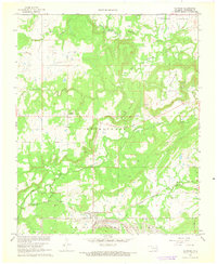 1966 Haywood1968 Print · USGSThe rural landscape of Pittsburg County comes into focus in the 1960s, showing a mix of military installations and quiet settlements. Genealogists can locate family landmarks like Christian Hill Cem, Arpelar Ch, and the sprawling U S Naval Ammunition Depot.2 unique versions available
 - 1967 Map of Fort Smith
 1967 Fort Smith1967 Print · USGSThe Arkansas River valley and the foothills of the Ozarks are captured here during a period of significant military and industrial activity. Researchers can trace the sprawling bounds of Camp Chaffee and Camp Gruber or locate vanished rail stops along the Midland Valley RR.
Showing maps 1-25 of 241
Top cities of Pittsburg County
- McAlester historical maps
- Krebs historical maps
- Hartshorne historical maps
- Quinton historical maps
- Haileyville historical maps
- Savanna historical maps
See more
Frequently asked questions
- What are the different types of historical maps available for Pittsburg County?
- What is the oldest map of Pittsburg County?
- Where can I purchase historical maps of Pittsburg County for my home or office?
- Where can I download high-res historical maps of Pittsburg County?
- Are there historical topographic maps available for Pittsburg County?
- Is there historical aerial imagery available for Pittsburg County?
- Where are historical maps of Pittsburg County sourced from?