1970s Maps of Pittsburg County, Oklahoma
Explore 22 historic maps of Pittsburg County from the 1970s. These maps offer a rare glimpse into what life looked like during the 1970s — showing old roads, neighborhoods, homes, and landmarks that have changed or disappeared over time.
Whether you're researching your family's past, planning a metal detecting trip, or studying how Pittsburg County's landscape evolved across the 1970s, these high-resolution maps are a powerful tool for exploring the history of this region.
- Focus on a specific era: All maps on this page are from the 1970s, giving you a focused view of this time period.
- See what’s changed: Compare century-old streets, trails, and buildings to today's modern landscape using overlays and satellite layers.
- Research with precision: Use these maps for genealogy, historical research, land use analysis, or educational projects.
- View, download, or print: Maps are fully viewable online in high resolution, and can be downloaded or printed for your own records.
Start exploring Pittsburg County's history through authentic maps from the 1970s. This is your window into the past.
Pittsburg County, OK maps
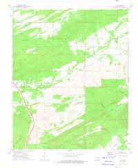
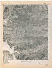
(22)- 1971 Map of Blocker, 1972 Print
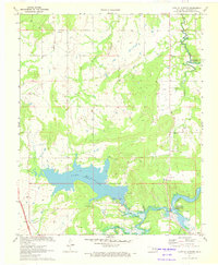
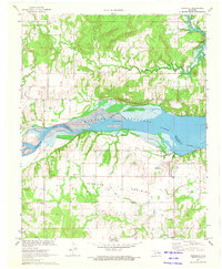
 1971 Blocker1972 Print · USGSIn the early 1970s, the Pittsburg County landscape was defined by the expansion of the Eufaula Reservoir and active energy extraction. Researchers can trace the Old RR Grade near Blocker or locate the Blocker Ch.4 unique versions available
 - 1971 Map of Wetumka SE, 1972 Print
 1971 Wetumka SE1972 Print · USGSThe Canadian River valley in the early seventies reveals a landscape defined by its waterways and regional energy production. Genealogists and local historians can trace family landmarks like the Tulmochasse Ch, Lamar Cem, and the tracks of the Missouri Pacific railroad.
 - 1971 Map of Crowder, 1972 Print
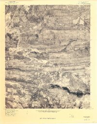
 1971 Crowder1972 Print · USGSThe town of Crowder and the expansive Eufaula Canadian Reservoir are documented here in the early 1970s. Researchers can locate small settlements like Bug Tussle and Mekko, or trace the Missouri Kansas Texas rail line through the shoreline.2 unique versions available
 - 1971 Map of Canadian, 1972 Print
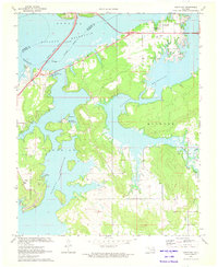
 1971 Canadian1972 Print · USGSThe shorelines of the McIntosh and Pittsburg county line are captured here in the early 1970s as new reservoirs reshaped the land. Researchers can trace family history through sites like Masonic Cem or the rural settlement at Mellette, and follow the path of the Missouri Kansas Texas line.2 unique versions available
 - 1971 Map of Lake Mc Alester, 1972 Print
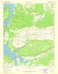
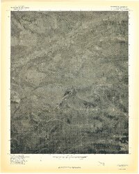
 1971 Lake Mc Alester1972 Print · USGSOklahoma's lake country in the early seventies shows a landscape defined by new reservoirs and the emerging turnpike system. Genealogists and local historians can pinpoint Mekko, Shady Grove Ch, and the recreation sites at Camp Hudgens.2 unique versions available
 - 1971 Map of Longtown, 1972 Print
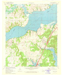
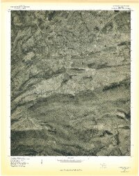
 1971 Longtown1972 Print · USGSThe Pittsburg and McIntosh County line was reshaped by the mid-century flooding of the Eufaula Reservoir. Researchers can trace the development of Arrowhead State Park and locate historic sites like Bower Cem and the Longtown settlement.
 - 1971 Map of Carson, 1973 Print
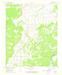 1971 Carson1973 Print · USGSThe rural landscape of Hughes County is captured here in the early 1970s, showcasing the intersection of the regional energy industry and rail transport. Researchers can trace the path of the Texas and Pacific railroad near Carson or locate numerous Oil Wells and a Pumping Station across the hills.2 unique versions available
 - 1971 Map of Scipio, 1973 Print
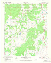 1971 Scipio1973 Print · USGSThe rural landscape of Pittsburg County comes into focus in the early seventies, detailing the small hubs of Scipio and Ulan. Genealogists can locate family landmarks like Lone Grove Cem, Hughlow Cem, and the community gathering point at Lone Grove Ch.2 unique versions available
 - 1971 Map of Indianola, 1973 Print
 1971 Indianola1973 Print · USGSIndianola and the Canadian River valley are captured here in the early seventies as the waters of Eufaula Reservoir reshaped the terrain. Genealogists and historians can trace local family landmarks like Choate Prairie Cem and the Old Railroad Grade.2 unique versions available
 - 1971 Map of Hanna, 1973 Print
 1971 Hanna1973 Print · USGSMcIntosh and Hughes counties are captured here in the early seventies as the local landscape adapted to the new Eufaula Reservoir. Researchers can trace family history at the Vernon Cem or locate rural landmarks like Weogufkee Ch and the Old Railroad Grade.2 unique versions available
 - 1973 Map of Adel, 1975 Print
 1973 Adel1975 Print · USGSSoutheast Oklahoma in the early 1970s is shown here as a landscape of heavy ridges and timbered valleys. Researchers can trace the St Louis San Francisco rail line through Finley or locate small settlements like Adel and Peveyhouse.
 - 1973 Map of Counts, 1975 Print
 1973 Counts1975 Print · USGSSoutheast Oklahoma at the start of the 1970s shows a landscape of tucked-away valleys and family-named cemeteries. Genealogists can trace local lineages through Burris Cem, Nace Cem, and the settlement at Counts.2 unique versions available
 - 1973 Map of Ti, 1975 Print
 1973 Ti1975 Print · USGSSoutheast Oklahoma in the early seventies shows a landscape defined by ridges and valley ranching before modern development. Genealogists and historians can trace family locations near Ti, Pine Top Cem, and the high reaches of New State Mountain.
 - 1973 Map of Redden, 1975 Print
 1973 Redden1975 Print · USGSThe Oklahoma hill country comes into focus in the early seventies as the toll road begins to modernize the landscape. Genealogists and local historians can trace family sites at Hewitt Cem and Baker Cem, or locate the rural crossroads of Redden.2 unique versions available
 - 1973 Map of Daisy, 1975 Print
 1973 Daisy1975 Print · USGSSoutheastern Oklahoma’s ridgelines and valleys are captured here in the early 1970s, showing the intersection of three counties. Researchers can locate remote burial sites like Mountain Home Cem and Bond Cem or trace the early path of the Indian Nation Toll Road.2 unique versions available
 - 1977 Map of Quinton South
 1977 Quinton South1977 Print · USGSThe eastern Oklahoma landscape comes into focus in the late seventies as the timbered ridges meet the valley floor. Genealogists and historians can trace rural homesteads and roads near Quinton, Lewisville, and the prominent Tucker Knob.
 - 1977 Map of Blocker
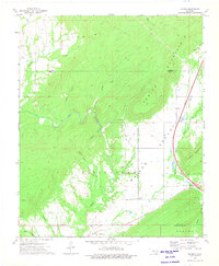
 1977 Blocker1977 Print · USGSThe settlement of Blocker and the surrounding Pittsburg County terrain are captured in this mid-seventies aerial survey. Researchers can trace the shoreline of Eufaula Lake and the natural heights of Scaffold Mountain and Blue Mountain.
 - 1977 Map of Adamson
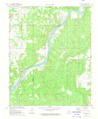
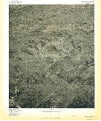
 1977 Adamson1977 Print · USGSThe Pittsburg County landscape in the late seventies is captured here through detailed aerial imagery centered on Adamson and Dow. Researchers can trace the sprawling base of Buffalo Mountain and the encroaching shoreline of Eufaula Lake near Gaines Creek.
 - 1977 Map of Featherston
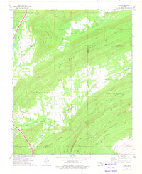
 1977 Featherston1977 Print · USGSFeatherston and the surrounding Pittsburg County landscape are seen from the air in the late seventies. Family historians and land researchers can trace the roads near Featherston and the timbered slopes of the Sans Bois Mountains.
 - 1977 Map of Hartshorne
 1977 Hartshorne1977 Print · USGSHartshorne and the surrounding Pittsburg County foothills are captured in this late-seventies aerial survey. Researchers can trace the street layouts of Hartshorne and Centerville or locate landmarks like Belle Starr Mountain and Hartshorne Lake.
 - 1978 Map of Eufaula, 1979 Print
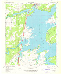
 1978 Eufaula1979 Print · USGSEastern Oklahoma in the late seventies is defined by the sprawling waters of Eufaula Lake and the dense timber of the Sans Bois Mountains. Genealogists and historians can trace the development of towns like Checotah and Stigler or locate legacy sites like the Old R R Grade and Robbers Cave State Park.
 - 1978 Map of Fort Smith, 1979 Print
 1978 Fort Smith1979 Print · USGSThe Arkansas-Oklahoma borderlands in the late seventies show a landscape shaped by massive river reservoirs and sprawling military reservations. Trace the historic rail lines of the Missouri Pacific RR and locate regional landmarks like Fort Gibson, Tenkiller Ferry Lake, and Barling.2 unique versions available
End of results
Showing maps 1-22 of 22
Top cities of Pittsburg County
- McAlester historical maps
- Krebs historical maps
- Hartshorne historical maps
- Quinton historical maps
- Haileyville historical maps
- Savanna historical maps
See more
Frequently asked questions
- What are the different types of historical maps available for Pittsburg County?
- What is the oldest map of Pittsburg County?
- Where can I purchase historical maps of Pittsburg County for my home or office?
- Where can I download high-res historical maps of Pittsburg County?
- Are there historical topographic maps available for Pittsburg County?
- Is there historical aerial imagery available for Pittsburg County?
- Where are historical maps of Pittsburg County sourced from?