1990s Maps of Oklahoma
Explore 74 historic maps of Oklahoma from the 1990s. These maps offer a rare glimpse into what life looked like during the 1990s — showing old roads, neighborhoods, homes, and landmarks that have changed or disappeared over time.
Whether you're researching your family's past, planning a metal detecting trip, or studying how Oklahoma's landscape evolved across the 1990s, these high-resolution maps are a powerful tool for exploring the history of this region.
- Focus on a specific era: All maps on this page are from the 1990s, giving you a focused view of this time period.
- See what’s changed: Compare century-old streets, trails, and buildings to today's modern landscape using overlays and satellite layers.
- Research with precision: Use these maps for genealogy, historical research, land use analysis, or educational projects.
- View, download, or print: Maps are fully viewable online in high resolution, and can be downloaded or printed for your own records.
Start exploring Oklahoma's history through authentic maps from the 1990s. This is your window into the past.
Oklahoma maps
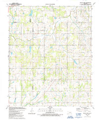
(74)- 1990 Map of Enid
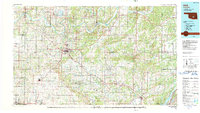
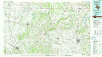
 1990 Enid1990 Print · USGSNorth-central Oklahoma's aviation and energy hubs are captured in the 1990s, from the streets of Stillwater to the runways of Vance Air Force Base. Researchers can locate active Oil and Gas Fields and trace local waterways like Skeleton Creek and Black Bear Creek.
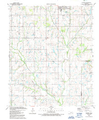
 - 1990 Map of Idabel
 1990 Idabel1990 Print · USGSThe tri-state borderlands of Oklahoma, Arkansas, and Texas come alive in this late twentieth-century survey of the Red River valley. Researchers can trace the legacy of rail and river commerce through settlements like Bokhoma and Ashdown or find rural landmarks such as Hill Chapel.
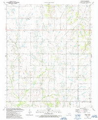
 - 1990 Map of Oklahoma City North
 1990 Oklahoma City North1990 Print · USGSOklahoma City and its northern reaches are captured in the 1990s as suburban growth stretched toward the Cimarron River. Genealogists and historians can trace rail-town legacies along the Atchison Topeka and Santa Fe Railroad and find landmarks like the El Reno Federal Reformatory.
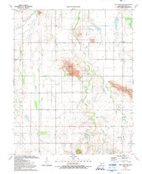
 - 1990 Map of Keystone Lake
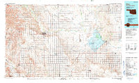
 1990 Keystone Lake1990 Print · USGSNorth-central Oklahoma's landscape is captured here in the 1990s as the vast waters of Keystone Lake meet the Osage Indian Reservation. Researchers can trace old rail corridors like the St Louis-San Francisco Railway and find local landmarks such as Pawnee Bill State Park or the Oil Field at Oilton.
 - 1990 Map of Ada
 1990 Ada1990 Print · USGSOklahoma's South Central plains and woodlands appear in high detail during the late twentieth century. Genealogists and historians can trace family roots in Ada, locate local institutions like East Central State University, and explore regional hubs like Sulphur or Stonewall.
 - 1990 Map of Alva
 1990 Alva1990 Print · USGSThe Oklahoma-Kansas borderlands in the 1990s reveal a landscape shaped by vast salt flats and crucial rail corridors. Genealogists and historians can trace the growth of Alva and Waynoka or locate landmarks like the State School for Boys and Little Sahara State Park.
 - 1990 Map of Bristow
 1990 Bristow1990 Print · USGSCentral Oklahoma's township and range grid is on full display in the 1990s, anchored by the crossroads at Bristow and Sapulpa. Researchers can trace old community lines and regional landmarks from Heyburn Reservoir to the historic streets of Boley.
 - 1990 Map of Foss Reservoir, 1991 Print
 1990 Foss Reservoir1991 Print · USGSWestern Oklahoma’s prairie and river systems are shown here as they appeared in the 1990s, dominated by conservation lands and water management. Researchers can trace the rail paths of the Atchison Topeka and Santa Fe and locate old rural centers like Strong City and Hammon.
 - 1991 Map of Laverty
 1991 Laverty1991 Print · USGSGrady and Caddo Counties are captured here in the early nineties, showing a landscape defined by local agriculture and the active oil and gas industry. Researchers can find deep family roots at Pioneer Cem, Woods Mem Cem, and the old settlement of Laverty.
 - 1991 Map of Fletcher
 1991 Fletcher1991 Print · USGSThe Oklahoma prairie south of the Caddo County line is captured here in the early nineties as energy production and transport routes define the landscape. Trace local family history at the Washita Indian Cemetery or locate old operations near Fletcher and Sterling.
 - 1991 Map of Gainesville
 1991 Gainesville1991 Print · USGSThe Red River borderlands of Texas and Oklahoma are captured here in the early nineties, showing a region defined by cattle history and oil production. Researchers can trace the layout of historic settlements like Spanish Fort and Belcherville or locate family landmarks near Queens Peak and Moss Lake.
 - 1991 Map of Denton
 1991 Denton1991 Print · USGSThe Oklahoma prairie at the start of the 1990s reveals a landscape defined by an active gas and oil field spanning three county lines. Genealogists and historians can trace family-named sites like Burris alongside the Woodlawn Cem and the Hurley Grove Community House.
 - 1991 Map of Letitia
 1991 Letitia1991 Print · USGSSouthern Oklahoma at the start of the nineties shows a landscape where petroleum production and farming coexist. Researchers can trace rural community centers like Pumpkin Center and Letitia, along with Hulen Church and the local Cemetery.
 - 1991 Map of Lawton
 1991 Lawton1991 Print · USGSLawton in the early nineties displays a bustling regional hub defined by expanding medical centers and academic campuses. Researchers can trace the town's evolution through landmarks like Cameron University, the Municipal Airport, and neighborhood schools like Eisenhower School.
 - 1991 Map of Cyril
 1991 Cyril1991 Print · USGSThe industrial and oil-producing heart of Caddo County comes into focus in the early nineties, centered on the towns of Cyril and Cement. Researchers can trace old family burial grounds like Celestial Gardens Cem and industrial landmarks such as the central Quarry.
 - 1991 Map of Rocky Ford
 1991 Rocky Ford1991 Print · USGSThe Oklahoma countryside at the turn of the 1990s reveals a complex network of oil production and rural life where Grady, Caddo, and Comanche counties meet. Researchers can trace family sites near Simpson Cem, explore the Rush Creek Oil and Gas Field, or locate the old community of Acme.
 - 1991 Map of Sterling
 1991 Sterling1991 Print · USGSThe ranching and energy country of the Oklahoma prairie is captured here in the early nineties. Genealogists and local historians can locate rural landmarks such as Midway Ch, the old settlement at Denton, and the concentrated Oil Field near Coxs Corner.
 - 1991 Map of Mc Alester
 1991 Mc Alester1991 Print · USGSSoutheastern Oklahoma’s coal and rail corridor is captured here during the early nineties, centered on the regional hub of McAlester. Local historians can trace the development of towns along the Missouri-Kansas-Texas RR and find landmarks like Sardis Lake and the State Penitentiary.
 - 1991 Map of Arbuckle Hill
 1991 Arbuckle Hill1991 Print · USGSOklahoma's military heartland is captured here during the late twentieth century, showing the intersection of historic training grounds and local genealogy. Researchers can trace the perimeter of the Fort Sill Military Reservation and locate old burials at Beef Creek Cem or Balitsos South Cem.
 - 1991 Map of Paris
 1991 Paris1991 Print · USGSNorthern Texas and southern Oklahoma meet along the Red River valley during the early nineties. Researchers can trace the rail networks of the Texas and Pacific RR and visit rural communities like Manchester, Sylvan, and Arthur City.
 - 1991 Map of Ninemile Creek
 1991 Ninemile Creek1991 Print · USGSEastern Lawton and the surrounding plains show a landscape of suburban growth and utility infrastructure in the early nineties. Genealogists and local historians can trace family-named sites like Flower Mound Cem and early aviation at the R & D Aviation Landing Strip.
 - 1991 Map of Fort Sill
 1991 Fort Sill1991 Print · USGSComanche County and the sprawling Fort Sill military complex appear in detail during the early nineties. Researchers can trace the layout of Fort Sill, find the Comanche Tribal Complex, and locate family sites near Highland Cemetery.
 - 1991 Map of Nellie
 1991 Nellie1991 Print · USGSStephens County petroleum country is captured here in the early nineties, showing the dense intersection of energy production and rural community life. Researchers can trace family roots at Rock Creek Cemetery or locate landmarks like Oil City, Nellie, and the Central High School.
 - 1991 Map of Unap Mountain, 1992 Print
 1991 Unap Mountain1992 Print · USGSOklahoma’s Kiowa County landscape is captured here in the early nineties, showing a mix of rugged peaks and vast ranchlands. Researchers can find the Union Dale Cem, the settlement of Sedan, and the remote Sugar Creek Ranch Landing Field.
 - 1991 Map of Taupa, 1992 Print
 1991 Taupa1992 Print · USGSComanche County is shown at the start of the nineties as a landscape of established rural communities and small-town growth. Researchers can locate specific family burial sites at Deyo Cem and Pecan Cem or trace the path of the old railroad grade.
Showing maps 1-25 of 74
Top cities of Oklahoma
- Oklahoma City historical maps
- Tulsa historical maps
- Norman historical maps
- Broken Arrow historical maps
- Lawton historical maps
- Edmond historical maps
See more
Top counties of Oklahoma
- Oklahoma County historical maps
- Cleveland County historical maps
- Canadian County historical maps
- Comanche County historical maps
- Rogers County historical maps
- Payne County historical maps
See more
Frequently asked questions
- What are the different types of historical maps available for Oklahoma?
- What is the oldest map of Oklahoma?
- Where can I purchase historical maps of Oklahoma for my home or office?
- Where can I download high-res historical maps of Oklahoma?
- Are there historical topographic maps available for Oklahoma?
- Is there historical aerial imagery available for Oklahoma?
- Where are historical maps of Oklahoma sourced from?