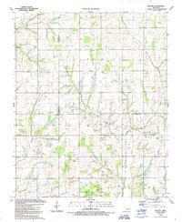
1991 Map of Denton
USGS Topo · Published 1991About this map
Denton anchors the western edge of this landscape where the borders of Comanche, Grady, and Stephens counties converge. The terrain is defined by the extensive Gas And Oil Field that stretches across the central and southern portions of the map, marked by a dense concentration of Oil Wells and Gas Wells. This industrial footprint is interspersed with rural gathering points like the Hurley Grove Community House and the Woodlawn Cem, indicating a community structured around both energy extraction and traditional social centers. Waterways such as Little Beaver Creek and Armstrong Creek wind through the region, occasionally diverted or utilized by the numerous Drill Holes that signal ongoing exploration. The presence of a Radio Tower and family-named landmarks like Burris further emphasize the mix of modern communication infrastructure and established local property holdings in this active Oklahoma energy corridor.
Find a feature on this map
19 named features on this map. Tap any name to fly to it.
Don’t see what you’re looking for? This feature index may not catch every label — zoom into the map to look around manually.
Map Details
Editions of this 1991 Denton Map
This is the sole edition of this map. No revisions or reprints were ever made.
Other maps of this area

1902 · Rush Springs
USGS Topo · 1:125,000

1949 · Cement
USGS Topo · 1:62,500

1949 · Nellie
USGS Topo · 1:62,500

1949 · Rush Springs
USGS Topo · 1:62,500

1950 · Rush Springs
USGS Topo · 1:62,500

1950 · Marlow
USGS Topo · 1:62,500

1951 · Marlow
USGS Topo · 1:62,500

1955 · Lawton
USGS Topo · 1:250,000

1956 · Sterling
USGS Topo · 1:24,000

1956 · Fletcher
USGS Topo · 1:24,000