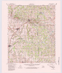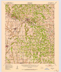
1949 Map of Cement
USGS Topo · Published 1953About this map
Cement and Cyril anchor this post-war landscape at the intersection of energy production and rural agriculture. The infrastructure of the petroleum industry is prominent, notably the Oil Refinery and Water Tower in Cyril, while the surrounding hills are organized into named districts such as North Cement and Chandler Field. These industrial sites contrast with a dense network of one-room schoolhouses and community hubs that served the farming population across the Little Washita River valley.
Find a feature on this map
46 named features on this map. Tap any name to fly to it.
Don’t see what you’re looking for? This feature index may not catch every label — zoom into the map to look around manually.
Map Details
Editions of this 1949 Cement Map
This is the sole edition of this map. No revisions or reprints were ever made.