
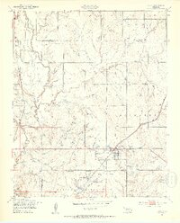
1949 Map of Elgin
USGS Topo · Published 1953About this map
The Fort Sill Military Reservation dominates the southern reaches of this landscape, its northern boundary and the Elgin Ridge marking a sharp transition into the agricultural and ranching country of southern Oklahoma. The town of Elgin serves as the primary hub, situated at the intersection of the St Louis San Francisco railroad and the rural road network. Local life in the late 1940s is anchored by institutions such as St Anthonys Ch, Elgin Cem, and rural educational outposts like Midway Sch and Happy Hollow Sch.
Find a feature on this map
29 named features on this map. Tap any name to fly to it.
Don’t see what you’re looking for? This feature index may not catch every label — zoom into the map to look around manually.
Map Details
Editions of this 1949 Elgin Map
2 editions found
Other maps of this area

1946 · Lawton
USGS Topo · 1:62,500

1949 · Arbuckle Hill
USGS Topo · 1:24,000

1949 · Cement
USGS Topo · 1:62,500

1949 · Fort Sill
USGS Topo · 1:24,000

1949 · Nellie
USGS Topo · 1:62,500

1955 · Lawton
USGS Topo · 1:250,000

1956 · Sterling
USGS Topo · 1:24,000

1956 · Fletcher
USGS Topo · 1:24,000

1956 · Arbuckle Hill
USGS Topo · 1:24,000

1956 · Boone
USGS Topo · 1:24,000