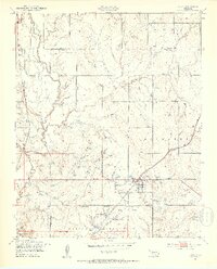
1949 Map of Elgin
USGS Topo · Published 1953About this map
Elgin serves as a central hub in this post-war landscape, situated at the intersection of significant rail lines and watercourses. The town is flanked by the St Louis San Francisco railroad and is bordered to the south by the Fort Sill Military Reservation Boundary. This proximity to the military installation is reflected in landmarks like Menard Tank, Rudd Tank, and O'Connell Tank located just inside the reservation line. Rural life outside the town is documented through the presence of Midway Sch and Happy Hollow Sch, along with the small settlement of Parker to the west. The drainage system is dominated by the winding path of East Cache Creek and its many tributaries, including Tony Creek and Chandler Creek, which carve through the terrain between Frisco Ridge and Elgin Ridge.
Find a feature on this map
22 named features on this map. Tap any name to fly to it.
Don’t see what you’re looking for? This feature index may not catch every label — zoom into the map to look around manually.
Map Details
Editions of this 1949 Elgin Map
2 editions found
Other maps of this area

1946 · Lawton
USGS Topo · 1:62,500

1949 · Arbuckle Hill
USGS Topo · 1:24,000

1949 · Cement
USGS Topo · 1:62,500

1949 · Elgin
USGS Topo · 1:24,000

1949 · Fort Sill
USGS Topo · 1:24,000

1949 · Nellie
USGS Topo · 1:62,500

1955 · Lawton
USGS Topo · 1:250,000

1956 · Sterling
USGS Topo · 1:24,000

1956 · Fletcher
USGS Topo · 1:24,000

1956 · Arbuckle Hill
USGS Topo · 1:24,000