
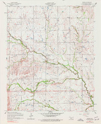
1956 Map of Boone
USGS Topo · Published 1959About this map
Boone and the surrounding Caddo County landscape are defined by a complex network of tributaries feeding into East Cache Creek during the mid-1950s. The map illustrates a rural Oklahoma community centered on faith and local gathering places, anchored by the Boone Memorial Church and the Bellview Church. Cultural heritage is deeply embedded in the land, as evidenced by the Comanche Indian Cemetery and Cache Creek Cemetery located in the southern portion of the quadrangle. Small clusters of development at Broxton and Hatchetville suggest a dispersed settlement pattern typical of the era, where rural schools and churches served as primary anchors. The terrain is intricately dissected by seasonal waterways like Tahoe Creek and Mission Creek, showing the drainage patterns that shaped local agriculture and road placement before modern highway expansion.
Find a feature on this map
17 named features on this map. Tap any name to fly to it.
Don’t see what you’re looking for? This feature index may not catch every label — zoom into the map to look around manually.
Map Details
Editions of this 1956 Boone Map
2 editions found
Other maps of this area

1949 · Elgin
USGS Topo · 1:24,000

1950 · Saddle Mountain
USGS Topo · 1:62,500

1951 · Fort Cobb
USGS Topo · 1:62,500

1955 · Lawton
USGS Topo · 1:250,000

1955 · Clinton
USGS Topo · 1:250,000

1956 · Alden
USGS Topo · 1:24,000

1956 · Elgin
USGS Topo · 1:24,000

1956 · Richards Spur
USGS Topo · 1:24,000

1956 · Meers
USGS Topo · 1:24,000

1956 · Apache
USGS Topo · 1:24,000