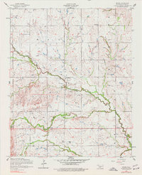
1956 Map of Boone
USGS Topo · Published 1977About this map
The community of Boone serves as the central hub of this mid-century Caddo County survey, which documents a landscape transitioning through agricultural and tribal heritage. The winding path of East Cache Creek and its various tributaries, including Tahoe Creek and Mission Creek, dictates the placement of early settlements and roads. Cultural landmarks are prominent throughout the area, notably the Comanche Indian Cemetery and Cache Creek Cemetery located near the southern margin, providing significant touchpoints for genealogical research and local history.
Find a feature on this map
16 named features on this map. Tap any name to fly to it.
Don’t see what you’re looking for? This feature index may not catch every label — zoom into the map to look around manually.
Map Details
Editions of this 1956 Boone Map
2 editions found
Other maps of this area

1949 · Elgin
USGS Topo · 1:24,000

1950 · Saddle Mountain
USGS Topo · 1:62,500

1951 · Fort Cobb
USGS Topo · 1:62,500

1955 · Lawton
USGS Topo · 1:250,000

1955 · Clinton
USGS Topo · 1:250,000

1956 · Alden
USGS Topo · 1:24,000

1956 · Boone
USGS Topo · 1:24,000

1956 · Elgin
USGS Topo · 1:24,000

1956 · Richards Spur
USGS Topo · 1:24,000

1956 · Meers
USGS Topo · 1:24,000