Old Maps of Edmond, Oklahoma
Explore 50 old maps of Edmond, spanning from 1892 to today. These high-resolution historic maps reveal how streets, neighborhoods, landmarks, and natural features evolved over time — perfect for genealogy, metal detecting, research, and local history exploration.
What you can do with these maps:
- See how Edmond changed over time: Compare historical maps to modern-day views to trace roads, homesites, rail lines & more.
- View detailed metadata: Each map includes creators, publishers, year, scale, and archive source.
- Overlay maps with satellite & LiDAR: Visualize the past alongside modern tools to explore terrain & human change.
- Trusted historical sources: Maps sourced from the USGS, Library of Congress, and other archives.
- Access maps your way: View online, download high-res files, or order prints for personal or research use.
Start exploring old maps of Edmond to uncover forgotten places, hidden landmarks, and the deep history beneath your feet.
Edmond, OK maps
(50)- 1892 Map of Edmond
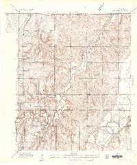
 1892 Edmond1892 Print · USGSOklahoma Territory was still in its first years of settlement when this survey was conducted, showing the vital rail corridor through Edmond. Researchers can trace early township boundaries and the paths of the Atchison Topeka and Santa Fe Railroad near Waterloo and Enfield.
 - 1892 Map of Kingfisher, 1957 Print
 1892 Kingfisher1957 Print · USGSOklahoma Territory was in a state of rapid transition during the 1890s as railroads and cattle trails shared the same landscape. Researchers can trace the original Chisholm Trail alongside early settlements like Mathewson and river crossings such as Kirby Ford.
 - 1895 Map of Kingfisher
 1895 Kingfisher1895 Print · USGSOklahoma Territory during the mid-1890s reveals a rapidly developing frontier defined by river crossings and expanding rail lines. Genealogists and historians can trace the early foundations of Kingfisher, Elreno, and Yukon alongside historic river crossings like Gould Ford.4 unique versions available
 - 1935 Map of Spencer
 1935 Spencer1935 Print · USGSOklahoma County in the mid-1930s shows a landscape of small rural settlements and schoolhouse districts before the post-war expansion. Researchers can trace family sites near Spencer or locate early landmarks like Harrison Sch (Colored) and the Oklahoma Electric Highway.
 - 1935 Map of Edmond
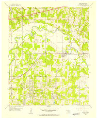
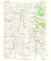
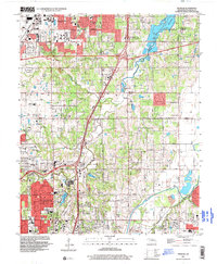
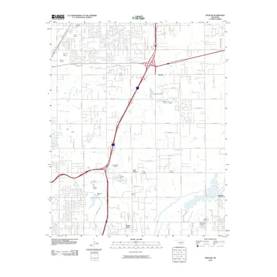
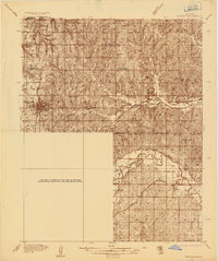 1935 Edmond1935 Print · USGSEdmond and its surrounding townships are captured in the mid-1930s as a vital transportation hub for central Oklahoma. Genealogists and historians can trace the early path of U S Highway No 66 and locate numerous rural landmarks like Wagner Cem and Mount Zion Sch.2 unique versions available
 - 1940 Map of Edmond
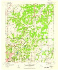
 1940 Edmond1940 Print · USGSOklahoma and Logan Counties are captured here in the years leading up to the war, showing a rural landscape anchored by rail towns. Researchers can trace family history through a dense network of country schools and cemeteries like Sunnyside Sch and Rose Hill Cem.2 unique versions available
 - 1951 Map of Britton, 1952 Print
 1951 Britton1952 Print · USGSOklahoma City's northern suburbs were rapidly evolving in the early fifties as residential tracts began to surround the massive Lake Hefner. Genealogists and historians can trace the growth of Britton, Nichols Hills, and Warr Acres alongside landmarks like Rose Hill Burial Park and the Wiley Post Airport.6 unique versions available
 - 1954 Map of Oklahoma City
 1954 Oklahoma City1954 Print · USGSOklahoma City and its surrounding counties are captured here in the early fifties during a period of significant postwar growth. Researchers can trace the development of the Turner Turnpike and locate aviation hubs like Tinker Field or Will Rogers Field.
 - 1955 Map of Jones, 1957 Print
 1955 Jones1957 Print · USGSOklahoma County in the mid-1950s shows a landscape of river-bottom industry and expanding rural townships. Genealogists can trace early neighborhood landmarks like Green Pastures, Rose Hill Sch, and the Odd Fellows Cem.4 unique versions available
 - 1956 Map of Spencer, 1957 Print
 1956 Spencer1957 Print · USGSNortheast Oklahoma City was a landscape of burgeoning suburbs and active oil fields during the mid-fifties. Genealogists and historians can locate numerous burial grounds like Arlington Memorial Park Cemetery and schools such as Oakdale Sch or Harrison Sch.3 unique versions available
 - 1957 Map of Oklahoma City, 1969 Print
 1957 Oklahoma City1969 Print · USGSCentral Oklahoma is captured here in a period of significant mid-century growth and industrialization. Researchers can trace family roots through numerous rural markers like Memory Lane Cem, New Hope School, and the sprawling grounds of Tinker Air Force Base.3 unique versions available
 - 1963 Map of Oklahoma City
 1963 Oklahoma City1963 Print · USGSCentral Oklahoma in the early sixties showcases a landscape of rapid suburban growth and established oil production. Researchers can trace historic rail lines like the Chicago Rock Island and Pacific RR or locate rural landmarks such as Mayflower School and Bethel Church.
 - 1966 Map of Arcadia, 1967 Print
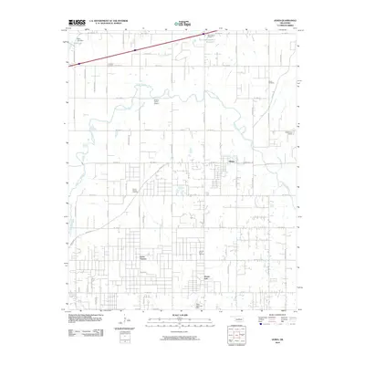
 1966 Arcadia1967 Print · USGSMid-century Oklahoma County is defined here by the intersection of the Missouri - Kansas - Texas railroad and early energy development. Genealogists and historians can trace family locations through numerous sites like Donnell Cem, IOOF Cem, and the growing community at Lake Hiwassee.3 unique versions available
 - 1966 Map of Edmond, 1967 Print
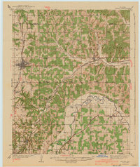
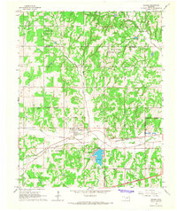
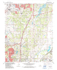
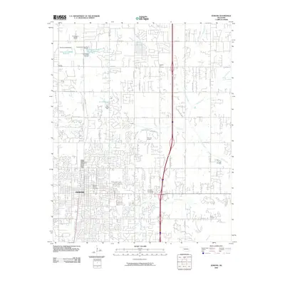
 1966 Edmond1967 Print · USGSEdmond and the surrounding rural townships are shown during a period of significant suburban growth in the mid-1960s. Researchers can trace the development of Central State College or locate family sites at Waterloo Cem and Pleasant Hill Cem.3 unique versions available
 - 1966 Map of Bethany NE, 1967 Print
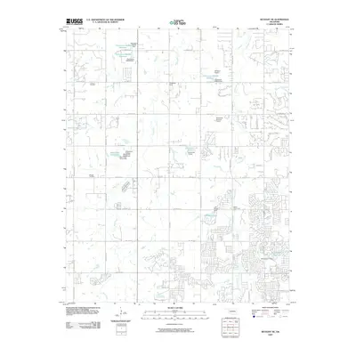
 1966 Bethany NE1967 Print · USGSOklahoma and Logan counties were in the midst of a suburban transition during the mid-sixties as municipal boundaries expanded. Local historians and genealogists can trace the rural roots of the area through landmarks like Christner Cem, Deer Creek Sch, and the Higbee Community Hall.3 unique versions available
 - 1986 Map of Spencer
 1986 Spencer1986 Print · USGSOklahoma City and Edmond undergo significant expansion during the mid-eighties as new reservoirs and highways reshape the suburban landscape. Genealogists and historians can trace numerous sites like Memorial Park Cemetery, Lake Aluma, and the Cowboy Hall of Fame.
 - 1986 Map of Britton, 1987 Print
 1986 Britton1987 Print · USGSOklahoma City's northern suburbs reached a period of rapid residential and commercial expansion during the mid-eighties. Researchers can trace the layout of Nichols Hills and The Village, locating landmarks like Rose Hill Burial Park and the historic rails of Britton.
 - 1990 Map of Oklahoma City North
 1990 Oklahoma City North1990 Print · USGSOklahoma City and its northern reaches are captured in the 1990s as suburban growth stretched toward the Cimarron River. Genealogists and historians can trace rail-town legacies along the Atchison Topeka and Santa Fe Railroad and find landmarks like the El Reno Federal Reformatory.
 - 1995 Map of Britton, 1999 Print
 1995 Britton1999 Print · USGSThe northern suburbs of Oklahoma City are shown in detail during the mid-nineties, capturing a landscape defined by rapid residential growth and water management. Researchers can locate family sites near Rose Hill Burial Park or trace the early paths of The Village and Britton.
 - 1995 Map of Spencer, 1999 Print
 1995 Spencer1999 Print · USGSThe northeast suburbs of Oklahoma City appear in the mid-nineties as a mix of growing residential districts and established institutions. Genealogists and local historians can trace family locations near Hebrew Cem, Piper Cem, and the historic Lone Star Ch.
 - 2009 Map of Bethany NE, 2009 Print
 2009 Bethany NE2009 Print · USGSCovers Edmond, including Oklahoma City, Guthrie, and other nearby areas
 - 2009 Map of Edmond, 2009 Print
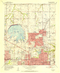
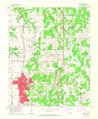
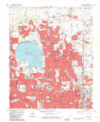
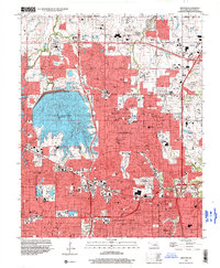
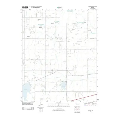
 2009 Edmond2009 Print · USGSCovers Edmond, including Guthrie, Waterloo, and other nearby areas
 - 2010 Map of Jones, 2010 Print
 2010 Jones2010 Print · USGSCovers Edmond, including Oklahoma City, Midwest City, and other nearby areas
 - 2010 Map of Spencer, 2010 Print
 2010 Spencer2010 Print · USGSCovers Edmond, including Oklahoma City, Midwest City, and other nearby areas
 - 2010 Map of Arcadia, 2010 Print
 2010 Arcadia2010 Print · USGSCovers Edmond, including Oklahoma City, Guthrie, and other nearby areas
Showing maps 1-25 of 50
Top cities near Edmond
- Oklahoma City historical maps
- Midwest City historical maps
- Del City historical maps
- Bethany historical maps
- Guthrie historical maps
- Choctaw historical maps
See more
Top neighborhoods of Edmond
- Waterloo historical maps
- Arrowhead Hills historical maps
- Arrowhead Trails historical maps
- Copperfield historical maps
- Bridgewater historical maps
- Delmer Lakes historical maps
See more
Frequently asked questions
- What are the different types of historical maps available for Edmond?
- What is the oldest map of Edmond?
- Where can I purchase historical maps of Edmond for my home or office?
- Where can I download high-res historical maps of Edmond?
- Are there historical topographic maps available for Edmond?
- Is there historical aerial imagery available for Edmond?
- Where are historical maps of Edmond sourced from?