2020s Maps of Edmond, Oklahoma
Explore 6 historic maps of Edmond from the 2020s. These maps offer a rare glimpse into what life looked like during the 2020s — showing old roads, neighborhoods, homes, and landmarks that have changed or disappeared over time.
Whether you're researching your family's past, planning a metal detecting trip, or studying how Edmond's landscape evolved across the 2020s, these high-resolution maps are a powerful tool for exploring the history of this region.
- Focus on a specific era: All maps on this page are from the 2020s, giving you a focused view of this time period.
- See what’s changed: Compare century-old streets, trails, and buildings to today's modern landscape using overlays and satellite layers.
- Research with precision: Use these maps for genealogy, historical research, land use analysis, or educational projects.
- View, download, or print: Maps are fully viewable online in high resolution, and can be downloaded or printed for your own records.
Start exploring Edmond's history through authentic maps from the 2020s. This is your window into the past.
Edmond, OK maps
(6)- 2022 Map of Bethany NE, 2022 Print
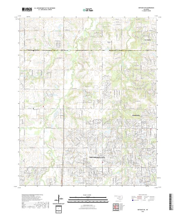 2022 Bethany NE2022 Print · USGSThe northern edge of the metropolitan area meets the Oklahoma prairie in this modern survey of the Logan Co and Oklahoma Co line. Genealogists can locate Christner Cem and Whisler Cem among the headwaters of Bloody Rush Cr.
 - 2022 Map of Jones, 2022 Print
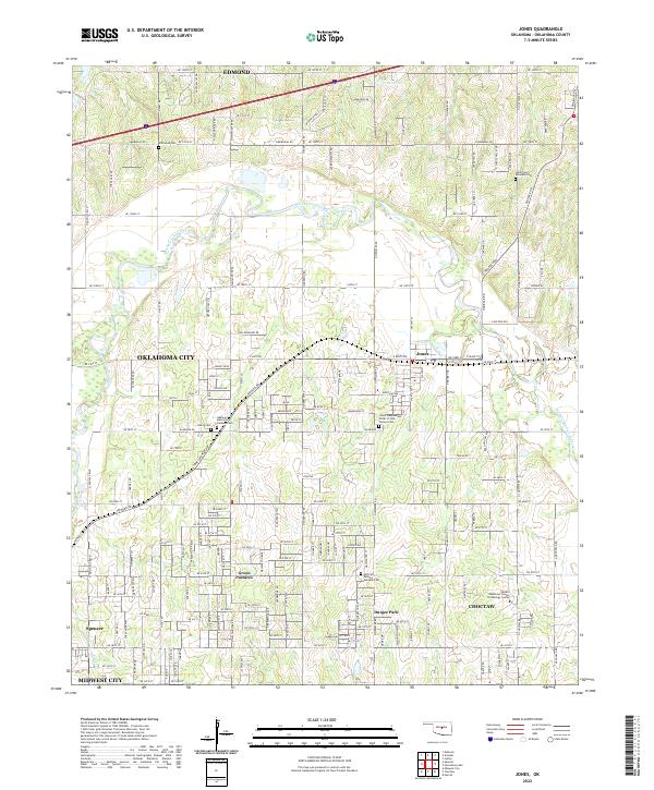 2022 Jones2022 Print · USGSOklahoma County at the start of the 2020s shows a landscape of growing communities and preserved family heritage north of the state capital. Genealogists can trace several local burial grounds including Chitwood Cem and Lillard and Woodard Cem.
 - 2022 Map of Spencer, 2022 Print
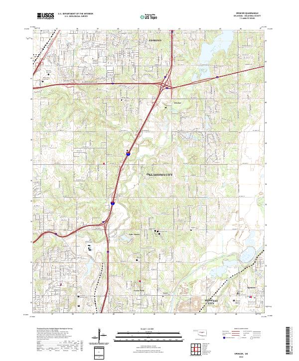 2022 Spencer2022 Print · USGSOklahoma County at the edge of the capital in 2022 shows the growth of Edmond and Forest Park along the Deep Fork. Trace local family history through numerous memorial sites like Trice Hill Cem, Witcher Cem, and Arlington Memory Gardens.
 - 2022 Map of Edmond, 2022 Print
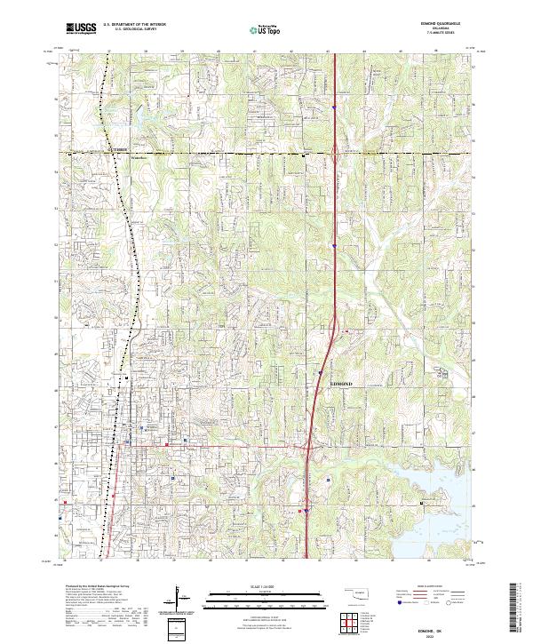 2022 Edmond2022 Print · USGSThe growing city of Edmond and the nearby settlement of Waterloo appear here during a period of significant suburban expansion in the early 2020s. Genealogists can trace local roots at Gracelawn Cem or explore the sprawling campus of the University of Central Oklahoma.
 - 2022 Map of Arcadia, 2022 Print
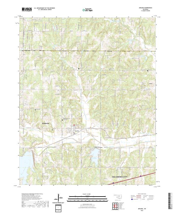 2022 Arcadia2022 Print · USGSArcadia and the surrounding Oklahoma countryside are captured here as the suburban reach of Edmond meets the rural landscape. Researchers can locate numerous local burial sites like Gower Cem and the Spigener Cem, or trace the winding course of the Deep Fork river.
 - 2022 Map of Britton, 2022 Print
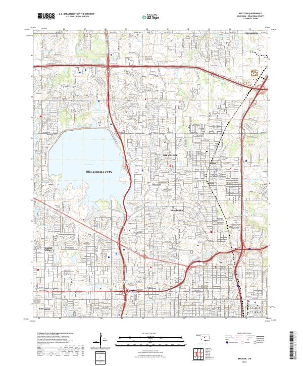 2022 Britton2022 Print · USGSOklahoma City and its northern suburbs are captured in this modern survey during a period of dense residential and commercial maturity. Researchers can trace municipal boundaries for Nichols Hills and The Village or locate historic sites like Britton Cem and Rose Hill Burial Park.
End of results
Showing maps 1-6 of 6
Top cities near Edmond
- Oklahoma City historical maps
- Midwest City historical maps
- Del City historical maps
- Bethany historical maps
- Guthrie historical maps
- Choctaw historical maps
See more
Top neighborhoods of Edmond
- Waterloo historical maps
- Arrowhead Hills historical maps
- Arrowhead Trails historical maps
- Copperfield historical maps
- Bridgewater historical maps
- Delmer Lakes historical maps
See more
Frequently asked questions
- What are the different types of historical maps available for Edmond?
- What is the oldest map of Edmond?
- Where can I purchase historical maps of Edmond for my home or office?
- Where can I download high-res historical maps of Edmond?
- Are there historical topographic maps available for Edmond?
- Is there historical aerial imagery available for Edmond?
- Where are historical maps of Edmond sourced from?