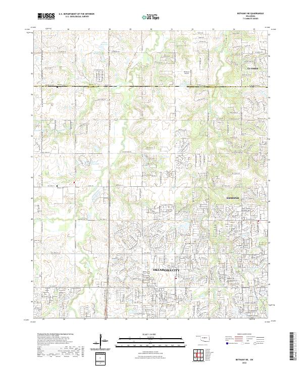
2022 Map of Bethany NE
USGS Topo · Published 2022About this map
Oklahoma City, Edmond, and Guthrie meet at the boundary of Logan Co and Oklahoma Co, showing a landscape transitioning from suburban expansion to rural ranching and open land. The southern portion of the map is defined by the dense residential street networks of north Oklahoma City and Edmond, while the northern sections toward Guthrie remain more open, marked by larger tracts and family-named landmarks. The terrain is drained by several waterways, including Deer Cr, Bluff Cr, and Bloody Rush Cr, which are dotted with small impoundments such as Deer Creek Farms Lake and Johnson Lake. This survey captures the intensive development reaching north along the Chisholm Creek corridor. Local history is anchored by rural burial grounds like Christner Cem and Whisler Cem, providing key points of reference for genealogists tracing early families in the region between the North Canadian and Cimarron River systems.
Find a feature on this map
184 named features on this map. Tap any name to fly to it.
Don’t see what you’re looking for? This feature index may not catch every label — zoom into the map to look around manually.
Map Details
Editions of this 2022 Bethany NE Map
This is the sole edition of this map. No revisions or reprints were ever made.
Other maps of this area

1892 · Guthrie
USGS Topo · 1:62,500

1892 · Edmond
USGS Topo · 1:62,500

1892 · Kingfisher
USGS Topo · 1:125,000

1895 · Kingfisher
USGS Topo · 1:125,000

1935 · Spencer
USGS Topo · 1:24,000

1935 · Edmond
USGS Topo · 1:48,000

1940 · Edmond
USGS Topo · 1:62,500

1951 · Britton
USGS Topo · 1:24,000

1954 · Oklahoma City
USGS Topo · 1:250,000
1956 · Spencer
USGS Topo · 1:24,000