Old Maps of Cherokee County, Oklahoma
Explore 160 old maps of Cherokee County, spanning from 1896 to today. These high-resolution historic maps reveal how streets, neighborhoods, landmarks, and natural features evolved over time — perfect for genealogy, metal detecting, research, and local history exploration.
What you can do with these maps:
- See how Cherokee County changed over time: Compare historical maps to modern-day views to trace roads, homesites, rail lines & more.
- View detailed metadata: Each map includes creators, publishers, year, scale, and archive source.
- Overlay maps with satellite & LiDAR: Visualize the past alongside modern tools to explore terrain & human change.
- Trusted historical sources: Maps sourced from the USGS, Library of Congress, and other archives.
- Access maps your way: View online, download high-res files, or order prints for personal or research use.
Start exploring old maps of Cherokee County to uncover forgotten places, hidden landmarks, and the deep history beneath your feet.
Cherokee County, OK maps
(160)- 1896 Map of Pryor, 1963 Print
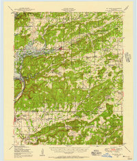
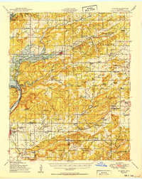
 1896 Pryor1963 Print · USGSThe Cherokee Nation comes into focus during the late nineteenth century as railroads began to transform the Indian Territory landscape. Genealogists and historians can trace essential river crossings like Sixkiller Ferry and Adams Ford or locate early settlements such as Bushyhead and Mazie.
 - 1898 Map of Tahlequah, 1954 Print
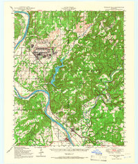
 1898 Tahlequah1954 Print · USGSThe Cherokee Nation capital and the surrounding Indian Territory come to life in this survey conducted before Oklahoma statehood. Genealogists can trace family-named landmarks and early institutions like the Female Seminary, Salem Springs, and the Cherokee Insane Asylum.
 - 1899 Map of Siloam Springs, 1954 Print
 1899 Siloam Springs1954 Print · USGSThe borderlands of the Cherokee Nation and Northwest Arkansas come alive in this late nineteenth-century survey. Genealogists can trace early homesteads and community life through Shoaps Store, Round Spring Church, and the settlement of Maysville.
 - 1901 Map of Muscogee
 1901 Muscogee1901 Print · USGSIndian Territory at the turn of the century shows a landscape shaped by river commerce and the coming of the railroads. Genealogists can trace family roots through early settlements like Tullahassee and Webbers Falls, or locate historic river crossings such as Whisky Ford.6 unique versions available
 - 1901 Map of Pryor
 1901 Pryor1901 Print · USGSIndian Territory at the turn of the century shows a landscape transitioning from tribal lands to a rail-connected frontier. Genealogists and historians can trace early river crossings like Markham Ferry and Dirteater Ford alongside frontier settlements like Choteau and Bushyhead.5 unique versions available
 - 1901 Map of Tahlequah
 1901 Tahlequah1901 Print · USGSTahlequah and the Cherokee Nation are captured here during the final years of the Indian Territory era. Genealogists can locate family landmarks such as the Female Seminary, Elm Springs Mission, and the rail-stop settlements of Stilwell and Wauhillau.8 unique versions available
 - 1903 Map of Siloam Springs, 1904 Print
 1903 Siloam Springs1904 Print · USGSThe border of Arkansas and the Cherokee Nation comes to life in this survey from the turn of the century. Genealogists and historians can trace the early layout of Siloam Springs or locate small landmarks like Shoaps Store and Round Spring Church.
 - 1904 Map of Siloam Springs
 1904 Siloam Springs1904 Print · USGSThe Arkansas and Indian Territory borderlands are captured here at the turn of the century, prior to Oklahoma statehood. Researchers can trace the early layout of Siloam Springs and locate vanished landmarks like Shoaps Store or the Round Spring Church.7 unique versions available
 - 1905 Map of Muscogee
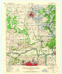
 1905 Muscogee1905 Print · USGSIndian Territory at the turn of the century shows a landscape transitioning from tribal nations to a rail-centered economy. Researchers can trace ancestral river crossings and early settlements like Fort Gibson, Tenkillers Ferry, and Gibson Sta.
 - 1905 Map of Tahlequah
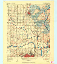
 1905 Tahlequah1905 Print · USGSTahlequah and the surrounding Cherokee Nation are captured here in the years before Oklahoma statehood. Researchers can trace the early rail routes and find historic sites like the Female Seminary, the Cherokee Orphan Asylum, and Elm Springs Mission.
 - 1946 Map of Fort Smith
 1946 Fort Smith1946 Print · USGSThe Arkansas-Oklahoma borderlands appear here in the mid-forties, as new reservoirs began to transform the river valleys. Genealogists and historians can trace rail-served towns from Muskogee to Fort Smith and locate landmarks like Camp Chaffee.
 - 1948 Map of Hulbert, 1957 Print
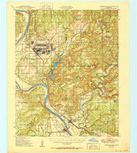
 1948 Hulbert1957 Print · USGSCherokee County at mid-century reveals a landscape of rural schoolhouses and family cemeteries just as the reservoir began to reshape the river valley. Genealogists can trace family roots through sites like Sequoyah Indian Sch, Lost City, and the Fort Gibson National Cem.3 unique versions available
 - 1948 Map of Webbers Falls, 1966 Print
 1948 Webbers Falls1966 Print · USGSThe Arkansas River valley at the close of the 1940s reveals a mix of wartime military expansion and traditional river settlements. Genealogists can locate family-named landmarks and rural institutions like South Bethel Cem, Howard Chapel, and Liberty Sch.2 unique versions available
 - 1948 Map of Wagoner, 1967 Print
 1948 Wagoner1967 Print · USGSThe river-confluence region of eastern Oklahoma is seen here just after the war, as the Fort Gibson Reservoir begins to take shape. Researchers can trace numerous rural landmarks like the Mulrow Ind Orphans Home, Tullahassee, and Blue Mound Cem.
 - 1950 Map of Wagoner
 1950 Wagoner1950 Print · USGSMid-century eastern Oklahoma is captured here as the Fort Gibson Reservoir project begins to reshape the river valleys. Genealogists and local historians can trace rural school districts and family landmarks from Tullahassee to the Murrow Ind Orphans Home.2 unique versions available
 - 1950 Map of Hulbert
 1950 Hulbert1950 Print · USGSOklahoma's Cherokee County appears here at a pivotal moment just after the war, as the Gibson Reservoir begins to reshape the landscape. Researchers can trace dozens of rural landmarks, including the Sequoyah Indian School, the Fort Gibson National Cemetery, and the Camp Gruber Military Reservation.2 unique versions available
 - 1950 Map of Webbers Falls
 1950 Webbers Falls1950 Print · USGSMid-century Muskogee County is captured here as a landscape of military readiness and Cherokee heritage. Researchers can trace the infrastructure of Camp Gruber or locate local landmarks like the Sour John Indian Sch and Howard Chapel.2 unique versions available
 - 1954 Map of Tulsa
 1954 Tulsa1954 Print · USGSNortheast Oklahoma and the Ozark border are shown here during a period of massive industrial and infrastructure growth. Researchers can trace the legacy of the Tri-State Mining District and the development of major reservoirs like Grand Lake O' The Cherokees.2 unique versions available
 - 1958 Map of Tulsa, 1968 Print
 1958 Tulsa1968 Print · USGSNortheast Oklahoma and the Ozark borderlands are captured here during a massive era of reservoir construction and highway expansion. Researchers can trace the mid-century footprints of Tulsa, the sprawling Lake O' the Cherokees, and historical sites like Pea Ridge National Military Park.3 unique versions available
 - 1963 Map of Tulsa
 1963 Tulsa1963 Print · USGSThe Oklahoma and Arkansas borderlands are shown here in the early sixties, a time of massive reservoir construction and heavy mining. Genealogists can trace family roots through settlements like Nowata, Pryor, and Jay, or locate historical zinc and lead mines and coal mines.
 - 1965 Map of Fort Smith
 1965 Fort Smith1965 Print · USGSEastern Oklahoma and Western Arkansas are captured here during a period of massive post-war change as new reservoirs reshaped the river valleys. Genealogists and historians can trace the rail networks of the Midland Valley RR and find established communities like Stilwell, Sallisaw, and Stigler.
 - 1967 Map of Fort Smith
 1967 Fort Smith1967 Print · USGSThe Arkansas River valley and the foothills of the Ozarks are captured here during a period of significant military and industrial activity. Researchers can trace the sprawling bounds of Camp Chaffee and Camp Gruber or locate vanished rail stops along the Midland Valley RR.
 - 1972 Map of Hulbert NE, 1974 Print
 1972 Hulbert NE1974 Print · USGSCherokee County appears in high-resolution detail in the early seventies, showing a landscape defined by cattle ranching and dense woodland. Genealogists and historians can trace property boundaries and land use near Kolpin Mountain and the banks of Fourteenmile Creek.
 - 1972 Map of Kansas, 1974 Print
 1972 Kansas1974 Print · USGSNortheastern Oklahoma at the edge of the Cookson Hills reveals a landscape of tight-knit valley communities in the early 1970s. Trace local family history through landmarks like Walnut Grove Mission, the Oaks Cem, and the winding waters of Black Fox Springs.
 - 1972 Map of Tahlequah, 1974 Print
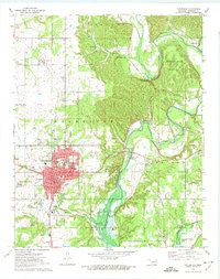 1972 Tahlequah1974 Print · USGSTahlequah and the Illinois River valley are captured in the early 1970s, showcasing a mix of academic growth and riverfront geography. Genealogists and historians can trace the footprint of Northeastern State College, locate the Manus Cem, and follow the OLD RAILROAD GRADE through the hills.3 unique versions available
Showing maps 1-25 of 160
Top cities of Cherokee County
Frequently asked questions
- What are the different types of historical maps available for Cherokee County?
- What is the oldest map of Cherokee County?
- Where can I purchase historical maps of Cherokee County for my home or office?
- Where can I download high-res historical maps of Cherokee County?
- Are there historical topographic maps available for Cherokee County?
- Is there historical aerial imagery available for Cherokee County?
- Where are historical maps of Cherokee County sourced from?