1970s Maps of Cherokee County, Oklahoma
Explore 32 historic maps of Cherokee County from the 1970s. These maps offer a rare glimpse into what life looked like during the 1970s — showing old roads, neighborhoods, homes, and landmarks that have changed or disappeared over time.
Whether you're researching your family's past, planning a metal detecting trip, or studying how Cherokee County's landscape evolved across the 1970s, these high-resolution maps are a powerful tool for exploring the history of this region.
- Focus on a specific era: All maps on this page are from the 1970s, giving you a focused view of this time period.
- See what’s changed: Compare century-old streets, trails, and buildings to today's modern landscape using overlays and satellite layers.
- Research with precision: Use these maps for genealogy, historical research, land use analysis, or educational projects.
- View, download, or print: Maps are fully viewable online in high resolution, and can be downloaded or printed for your own records.
Start exploring Cherokee County's history through authentic maps from the 1970s. This is your window into the past.
Cherokee County, OK maps
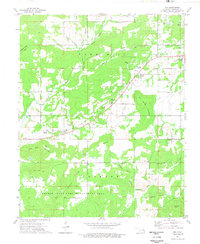
(32)- 1972 Map of Hulbert NE, 1974 Print
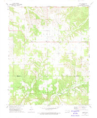
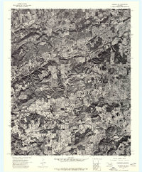 1972 Hulbert NE1974 Print · USGSCherokee County appears in high-resolution detail in the early seventies, showing a landscape defined by cattle ranching and dense woodland. Genealogists and historians can trace property boundaries and land use near Kolpin Mountain and the banks of Fourteenmile Creek.
 - 1972 Map of Kansas, 1974 Print
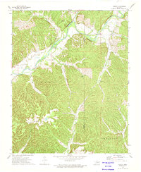
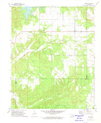
 1972 Kansas1974 Print · USGSNortheastern Oklahoma at the edge of the Cookson Hills reveals a landscape of tight-knit valley communities in the early 1970s. Trace local family history through landmarks like Walnut Grove Mission, the Oaks Cem, and the winding waters of Black Fox Springs.
 - 1972 Map of Tahlequah, 1974 Print
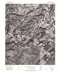
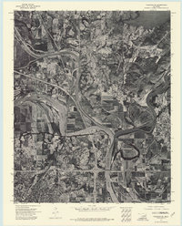
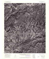
 1972 Tahlequah1974 Print · USGSTahlequah and the Illinois River valley are captured in the early 1970s, showcasing a mix of academic growth and riverfront geography. Genealogists and historians can trace the footprint of Northeastern State College, locate the Manus Cem, and follow the OLD RAILROAD GRADE through the hills.3 unique versions available
 - 1972 Map of Hulbert SE, 1974 Print
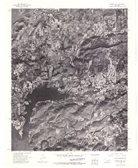
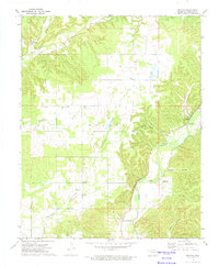
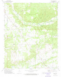
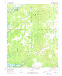
 1972 Hulbert SE1974 Print · USGSCherokee County, Oklahoma, is seen from the air in the early seventies, capturing the rural landscape of the Ozark foothills. Researchers can trace the wooded slopes of Redberry Mountain and the banks of Bayou Manard and Greenleaf Creek.
 - 1972 Map of Leach, 1974 Print
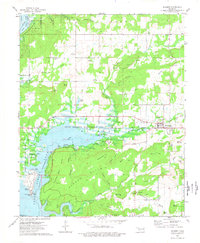
 1972 Leach1974 Print · USGSNortheastern Oklahoma's rural landscape comes into focus during the early seventies, centered on the community of Leach. Genealogists and local historians can trace old community hubs at Lowery Cem, Leach Sch, and the river crossing at Rockyford Ford.2 unique versions available
 - 1972 Map of Chewey, 1974 Print
 1972 Chewey1974 Print · USGSThe Illinois River valley in the early 1970s reveals a secluded landscape of deep hollows and river bends along the Adair and Cherokee county line. Researchers can trace rural landmarks like Thompson Cem, the Hampton Bridge, and the small settlement of Chewey.
 - 1972 Map of Wagoner SE, 1974 Print
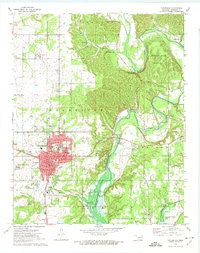
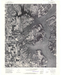
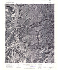
 1972 Wagoner SE1974 Print · USGSMuskogee and the Three Forks river convergence are captured in high detail in the early 1970s. Trace the winding paths of the Verdigris River, Neosho River, and Arkansas River alongside the streets of Muskogee and Fort Gibson.
 - 1972 Map of Hulbert NW, 1974 Print
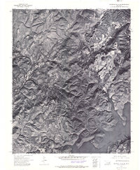
 1972 Hulbert NW1974 Print · USGSCherokee County in the early seventies is seen here through high-altitude aerial imagery, capturing the landscape just as it appeared on a December day. Researchers can trace the wooded shorelines of Fort Gibson Lake and the road network around Hulbert.
 - 1972 Map of Wagoner NE, 1974 Print
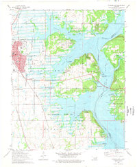
 1972 Wagoner NE1974 Print · USGSNortheastern Oklahoma's landscape is captured in the early seventies, showcasing the expansive reach of Fort Gibson Lake. Local historians can trace the development of Wagoner and the intricate shoreline that reshaped this region.
 - 1972 Map of Tailholt, 1974 Print
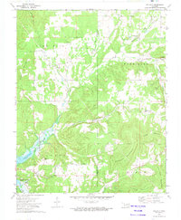 1972 Tailholt1974 Print · USGSCherokee County in the early seventies shows the rural life of the Cookson Hills as the waters of Tenkiller Ferry Lake reached their modern levels. Researchers can trace historic local sites like Tailholt, the Tenkiller Sch, and several remote family burial grounds including Stony Point Cem.2 unique versions available
 - 1972 Map of Webbers Falls NE, 1974 Print
 1972 Webbers Falls NE1974 Print · USGSEastern Oklahoma's hills and timberlands are captured here in the early seventies as the lake era reshaped the landscape. Trace the rugged shorelines of Tenkiller Ferry Lake and the settlement at White Oak on this detailed aerial survey.
 - 1972 Map of Moodys, 1974 Print
 1972 Moodys1974 Print · USGSCherokee County at the start of the 1970s shows a landscape of small upland settlements and riverside bluffs. Genealogists can locate Agent Cem, Lowrey Sch, and numerous country churches like Faith Chapel and Molly Field Ch.
 - 1972 Map of Peggs, 1974 Print
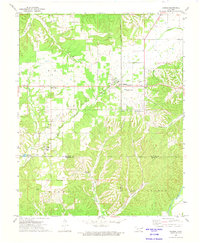
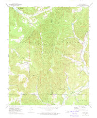
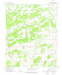
 1972 Peggs1974 Print · USGSSettled rural Cherokee County comes into focus in the early seventies, centered on the community of Peggs. Local researchers can trace family landmarks like Peggs Cem, Gideon, and country churches including Blue Springs Ch and New Home Ch.
 - 1972 Map of Bunch, 1974 Print
 1972 Bunch1974 Print · USGSThe Cookson Hills of eastern Oklahoma are captured here in the early seventies, spanning the borders of Adair and Cherokee counties. Researchers can locate the mountain village of Bunch, follow the Kansas City Southern rail line, or trace family sites like Cave Springs Ch and Henderson Cem.
 - 1972 Map of Cookson, 1974 Print
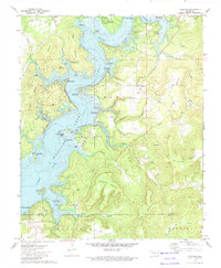 1972 Cookson1974 Print · USGSCherokee County in the early 1970s shows a landscape transformed by the waters of Tenkiller Ferry Lake. Genealogists and local researchers can trace the roads around Cookson and Red Springs or locate family sites near the Cookson Cem.3 unique versions available
 - 1972 Map of Proctor, 1974 Print
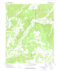 1972 Proctor1974 Print · USGSAdair and Cherokee Counties are captured in the early seventies, showing a landscape of river valleys and rugged foothills. Genealogists can trace family names and local sites like Oakdale Church, the community of Titanic, and the Old Railroad Grade near Eldon.2 unique versions available
 - 1972 Map of Cedar Crest, 1974 Print
 1972 Cedar Crest1974 Print · USGSThe eastern shores of Fort Gibson Lake are shown here in the early 1970s, where Mayes, Wagoner, and Cherokee counties meet. Local historians can trace family sites like Gray Cem and Downing Cem or follow the route to Earbob Ferry.
 - 1972 Map of Hulbert SW, 1974 Print
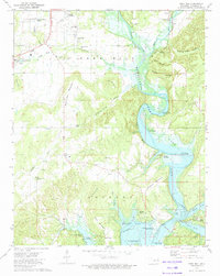
 1972 Hulbert SW1974 Print · USGSThe river and rail corridor of Muskogee County appears in remarkable detail during the early 1970s. Trace the industrial and residential footprint of Fort Gibson near the Fort Gibson Dam and the wide expanse of Fort Gibson Lake.
 - 1972 Map of Rose, 1974 Print
 1972 Rose1974 Print · USGSNortheast Oklahoma in the early 1970s is shown as a network of small family-named settlements and rural schoolhouses. Genealogists can trace family footprints through sites like Little Rock Cem, Smith Chapel, and the Rose Lookout Tower.
 - 1973 Map of Park Hill, 1974 Print
 1973 Park Hill1974 Print · USGSNear the Illinois River in the 1970s, this Cherokee County landscape reveals a deep history of settlement and community life. Researchers can locate family sites at Ross Cem, explore Tsa La Gi Indian Village, or trace the shoreline near Carters Landing.2 unique versions available
 - 1974 Map of Webbers Falls NW
 1974 Webbers Falls NW1974 Print · USGSMuskogee County in the early seventies is revealed through this detailed aerial survey, showing the transition of the local landscape. Genealogists and historians can trace the footprint of Camp Gruber (Abandoned) and the small town of Braggs alongside Greenleaf Lake.3 unique versions available
 - 1974 Map of Wagoner East, 1978 Print
 1974 Wagoner East1978 Print · USGSThe lakeside community of Wagoner and the eastern shores of Fort Gibson Lake are captured here in the mid-seventies. Genealogists and local historians can trace legacy sites like Elmwood Cem and Ora Ellington Sch alongside the busy Missouri Pacific Railroad.
 - 1974 Map of Thompson Corner, 1978 Print
 1974 Thompson Corner1978 Print · USGSCherokee County in the mid-seventies is documented here as a landscape of rural communities and hilltop cemeteries. Genealogists and local historians can trace family roots through landmarks like Thompson Corner, New Hope Ch, and the Houston Cem.
 - 1974 Map of Hulbert, 1978 Print
 1974 Hulbert1978 Print · USGSCherokee County at the height of the mid-seventies shows a landscape shaped by water and wildlife conservation. Researchers can trace family history at Hinson Cem and Lower Ray Cem or locate old community centers like Lost City and Keener Ch.
 - 1974 Map of Zeb, 1978 Print
 1974 Zeb1978 Print · USGSCherokee County in the mid-1970s shows a landscape of small settlements and family cemeteries nestled between the Cookson hills. Genealogists can trace family lines through the Jones Cem, Lowrey Cem, and Hendricks Cem or find old school sites like Stone Chapel Sch.
Showing maps 1-25 of 32
Top cities of Cherokee County
Frequently asked questions
- What are the different types of historical maps available for Cherokee County?
- What is the oldest map of Cherokee County?
- Where can I purchase historical maps of Cherokee County for my home or office?
- Where can I download high-res historical maps of Cherokee County?
- Are there historical topographic maps available for Cherokee County?
- Is there historical aerial imagery available for Cherokee County?
- Where are historical maps of Cherokee County sourced from?