1970s Maps of Oklahoma
Explore 554 historic maps of Oklahoma from the 1970s. These maps offer a rare glimpse into what life looked like during the 1970s — showing old roads, neighborhoods, homes, and landmarks that have changed or disappeared over time.
Whether you're researching your family's past, planning a metal detecting trip, or studying how Oklahoma's landscape evolved across the 1970s, these high-resolution maps are a powerful tool for exploring the history of this region.
- Focus on a specific era: All maps on this page are from the 1970s, giving you a focused view of this time period.
- See what’s changed: Compare century-old streets, trails, and buildings to today's modern landscape using overlays and satellite layers.
- Research with precision: Use these maps for genealogy, historical research, land use analysis, or educational projects.
- View, download, or print: Maps are fully viewable online in high resolution, and can be downloaded or printed for your own records.
Start exploring Oklahoma's history through authentic maps from the 1970s. This is your window into the past.
Oklahoma maps
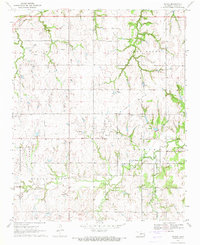
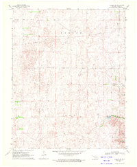
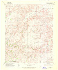
(554)- 1970 Map of Muldrow SW
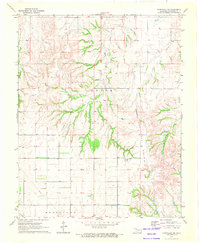
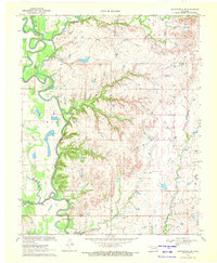
 1970 Muldrow SW1970 Print · USGSLe Flore County in the late seventies is captured in this orthophoto survey, showcasing the winding Arkansas River and its rural borderlands. Researchers can trace land divisions near Tucker or follow the paths of Onion Creek and Cache Creek as they weave through the valley.
 - 1970 Map of Navina, 1971 Print
 1970 Navina1971 Print · USGSLogan County farmland and the community of Navina are captured here in 1970, showing the region as its rail-dependent past gave way to modern utility corridors. Researchers can trace the path of an Old Railroad Grade and locate local landmarks like Harmony Cem and Iron Mound.2 unique versions available
 - 1970 Map of Bushyhead, 1971 Print
 1970 Bushyhead1971 Print · USGSNorth of Claremore in the early seventies, this Rogers County landscape shows a mix of traditional prairie life and heavy industry. Genealogists can trace family landmarks like Dawes Cem and Beck Cem, while mapping the impact of the Strip Mine operations and the St Louis - San Francisco railroad.2 unique versions available
 - 1970 Map of Arnett, 1972 Print
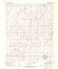 1970 Arnett1972 Print · USGSWestern Oklahoma’s high plains are documented here in the early seventies, centered on the county seat of Arnett. Genealogists and historians can trace the Old Indian Treaty Boundary and locate family sites at Debolt Cem or the Seventh-Day Adventist Cem.
 - 1970 Map of Wainwright, 1972 Print
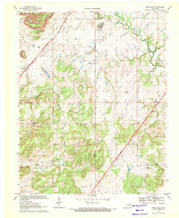
 1970 Wainwright1972 Print · USGSCentral Muskogee County and northern McIntosh County appear in the early seventies as a rural landscape of ranching and energy. Genealogists can trace family names and landmarks like Middleton Cem and the Missouri - Kansas - Texas railroad line.
 - 1970 Map of Fairvalley SW, 1972 Print
 1970 Fairvalley SW1972 Print · USGSWoodward County's energy and ranching landscape is captured in the early 1970s, as the industrial footprint expanded into rural Oklahoma. Trace the development of the Oil and Gas Field and its infrastructure, including a Pumping Station, Pipeline, and isolated Landing Strip.
 - 1970 Map of Chelsea, 1972 Print
 1970 Chelsea1972 Print · USGSNortheast Oklahoma's extraction landscape is on full display during the early 1970s, as coal and oil operations surround the town of Chelsea. Researchers can trace family history at Shady Grove Cem and Snider Cem or locate industrial sites like the many Strip Mines and the St Louis - San Francisco rail line.3 unique versions available
 - 1970 Map of Evansville, 1972 Print
 1970 Evansville1972 Print · USGSSettled valleys and mountain ridges define the Arkansas-Oklahoma border during the early seventies. Genealogists can trace family roots through numerous burial sites like Vineyard Cem, Goddard Cem, and the community of Dutch Mills.3 unique versions available
 - 1970 Map of Guthrie North, 1972 Print
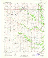
 1970 Guthrie North1972 Print · USGSNorth of Guthrie in the early 1970s, the river valley landscape is shaped by the sweeping Cimarron River and its rail corridors. Researchers can locate family landmarks like Summit View Cemetery, the Masonic Temple, and small settlements at Lawrie and Camp Joy.3 unique versions available
 - 1970 Map of Harmon, 1972 Print
 1970 Harmon1972 Print · USGSNorthwestern Oklahoma in the early seventies reveals a landscape defined by ranching and the energy industry. Researchers can trace the Old Indian Treaty Boundary and locate local landmarks like the Harmon Cem and the Oil Refinery.2 unique versions available
 - 1970 Map of Alabaster Caverns, 1972 Print
 1970 Alabaster Caverns1972 Print · USGSWoodward County's gypsum-rich landscape is captured in the early seventies, centered on the unique subterranean systems of the region. Genealogists and explorers can locate Haskew Cem, the Community Center, and the surface layout of Alabaster Caverns State Park.
 - 1970 Map of Osage Hills, 1972 Print
 1970 Osage Hills1972 Print · USGSNortheast Oklahoma's rural landscape is captured here in the early seventies, showing the intersection of new infrastructure and established local settlements. Genealogists and historians can trace family-named sites like Vann Cem and Union Chapel, or explore the development around Harmony Star and the Will Rogers Toll Road.2 unique versions available
 - 1970 Map of Arnett SE, 1972 Print
 1970 Arnett SE1972 Print · USGSThe rural borders of Ellis and Roger Mills counties are documented here in 1970, centered on the Canadian River valley. Researchers can locate the Grand Cem and trace the paths of Mosquito Creek and Commission Creek.
 - 1970 Map of Council Hill, 1972 Print
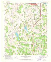
 1970 Council Hill1972 Print · USGSCouncil Hill and Hitchita appear at the convergence of three Oklahoma counties in the early seventies, just as the regional landscape was being reshaped. Genealogists and researchers can trace family sites at the Council Hill Cem, Ridley Cem, and New Hope Ch while exploring the developing shoreline of the Eufaula Reservoir.2 unique versions available
 - 1970 Map of Terlton, 1972 Print
 1970 Terlton1972 Print · USGSNear the convergence of Pawnee and Creek counties in the early 1970s, this map shows a landscape shaped by petroleum and the rising waters of the Keystone Reservoir. Trace the Old Indian Territory Oklahoma Territory Boundary alongside Terlton and the many Oil Wells that defined the local economy.2 unique versions available
 - 1970 Map of Harmon SW, 1972 Print
 1970 Harmon SW1972 Print · USGSEllis County's energy landscape is captured here in the early seventies during a period of active fossil fuel development. Researchers can trace the extent of the Benton Gas and Oil Field and locate water sources like Carlton Lake and Little Cottonwood Lake.
 - 1970 Map of Guthrie South, 1972 Print
 1970 Guthrie South1972 Print · USGSLogan County, Oklahoma, comes into focus in the early seventies as the area around Guthrie balances its oil production and aviation growth. Researchers can trace family history through Seward Cem, find the old Faubion Sch, or follow the old RR grade.3 unique versions available
 - 1970 Map of Knowles, 1972 Print
 1970 Knowles1972 Print · USGSKnowles and the surrounding High Plains of Beaver County are captured here during the height of the region's energy production in the early seventies. Genealogists and historians can trace the Missouri-Kansas-Texas railroad corridor and the network of Gas Wells that dotted the landscape near the Beaver River.
 - 1970 Map of Arnett SW, 1972 Print
 1970 Arnett SW1972 Print · USGSThe Oklahoma-Texas border comes into focus in 1970, showing the high plains landscape of Ellis County during a period of steady resource extraction. You can trace the rural landscape from Allmon Cem to the waters of Lake Lloyd Vincent and the Little Robe drainage.
 - 1970 Map of Bartlesville SE, 1972 Print
 1970 Bartlesville SE1972 Print · USGSThe tri-county borderlands of northeastern Oklahoma are captured here in the early 1970s, showcasing a landscape of winding river bends and prairie creeks. Researchers can locate infrastructure of the local economy, including the Tyner Dam, a riverside Oil Well, and the Gravel Pit.2 unique versions available
 - 1970 Map of Gate, 1972 Print
 1970 Gate1972 Print · USGSThe Oklahoma panhandle town of Gate is captured here during its mid-century energy boom. Researchers can trace the Missouri-Kansas-Texas rail line and locate rural landmarks like Zelma Cem, Cline Cem, and Gate Lake.
 - 1970 Map of Goodwin, 1972 Print
 1970 Goodwin1972 Print · USGSThe Oklahoma Panhandle borderlands are captured here in the early seventies as the cattle and rail economy shaped Ellis County. Genealogists and historians can trace the Atchison Topeka and Santa Fe rail line past Goodwin and the Old Indian Treaty Boundary.
 - 1970 Map of Lookout, 1972 Print
 1970 Lookout1972 Print · USGSThe Oklahoma-Kansas borderlands in the early 1970s reveal a landscape shaped by the energy industry and rural community life. Researchers can trace the sprawling Patterson Oil and Gas Field and locate landmarks like Lookout Ch and the Coy Community Hall.
 - 1970 Map of Chouteau NW, 1972 Print
 1970 Chouteau NW1972 Print · USGSNortheast Oklahoma at the start of the seventies reveals a rural landscape anchored by the Missouri Pacific railroad and family-centered landmarks. Genealogists and local historians can locate the Amish Cem, Brethren Cem, and the prominent Scaly Bark Mountain.
 - 1970 Map of Fairvalley SE, 1972 Print
 1970 Fairvalley SE1972 Print · USGSNorthwest Oklahoma's energy landscape is captured here just as the petroleum industry expanded across Woodward County. Researchers can locate family landmarks like Highland Cem and distinct natural features such as Chimney Rock and Doe Creek.
Showing maps 1-25 of 554
Top cities of Oklahoma
- Oklahoma City historical maps
- Tulsa historical maps
- Norman historical maps
- Broken Arrow historical maps
- Lawton historical maps
- Edmond historical maps
See more
Top counties of Oklahoma
- Oklahoma County historical maps
- Cleveland County historical maps
- Canadian County historical maps
- Comanche County historical maps
- Rogers County historical maps
- Payne County historical maps
See more
Frequently asked questions
- What are the different types of historical maps available for Oklahoma?
- What is the oldest map of Oklahoma?
- Where can I purchase historical maps of Oklahoma for my home or office?
- Where can I download high-res historical maps of Oklahoma?
- Are there historical topographic maps available for Oklahoma?
- Is there historical aerial imagery available for Oklahoma?
- Where are historical maps of Oklahoma sourced from?