1940s Maps of Oklahoma
Explore 38 historic maps of Oklahoma from the 1940s. These maps offer a rare glimpse into what life looked like during the 1940s — showing old roads, neighborhoods, homes, and landmarks that have changed or disappeared over time.
Whether you're researching your family's past, planning a metal detecting trip, or studying how Oklahoma's landscape evolved across the 1940s, these high-resolution maps are a powerful tool for exploring the history of this region.
- Focus on a specific era: All maps on this page are from the 1940s, giving you a focused view of this time period.
- See what’s changed: Compare century-old streets, trails, and buildings to today's modern landscape using overlays and satellite layers.
- Research with precision: Use these maps for genealogy, historical research, land use analysis, or educational projects.
- View, download, or print: Maps are fully viewable online in high resolution, and can be downloaded or printed for your own records.
Start exploring Oklahoma's history through authentic maps from the 1940s. This is your window into the past.
Oklahoma maps
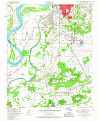
(38)- 1940 Map of Edmond
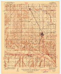
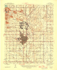
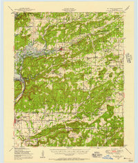
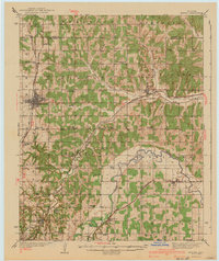 1940 Edmond1940 Print · USGSOklahoma and Logan Counties are captured here in the years leading up to the war, showing a rural landscape anchored by rail towns. Researchers can trace family history through a dense network of country schools and cemeteries like Sunnyside Sch and Rose Hill Cem.2 unique versions available
 - 1940 Map of Red Oak, 1971 Print
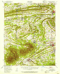
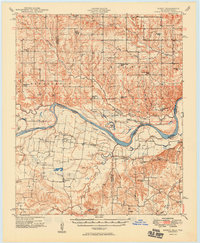
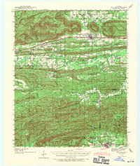 1940 Red Oak1971 Print · USGSThe Ouachita Mountains of southeastern Oklahoma are captured here in the years just before the mid-century, showing a landscape of timbered ridges and railroad towns. Genealogists can trace family footprints at rural landmarks like Baldwin Cem, the Salonia Sch, and the State Sanitorium near Talihina.2 unique versions available
 - 1941 Map of Fort Reno
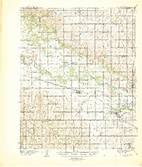 1941 Fort Reno1941 Print · USGSThe North Canadian River valley was a center of agricultural and military life in the late thirties. Genealogists can trace family footprints across dozens of country schools and churches like Sunny Hill Sch, Swappingback Indian Chapel, and the historic Fort Reno grounds.3 unique versions available
 - 1942 Map of Cache
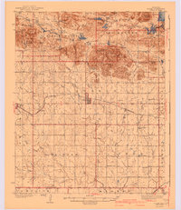 1942 Cache1942 Print · USGSComanche County during the late 1930s reveals a unique landscape where the Wichita Mountains Wildlife Refuge meets the rail-side towns of the plains. Genealogists can trace rural life through sites like Post Oak Mission, Devo Memorial Chapel, and the Spring Valley Sch.3 unique versions available
 - 1942 Map of Fort Reno
 1942 Fort Reno1942 Print · USGSOklahoma's Canadian County plains come alive in this early-forties survey, showcasing a landscape defined by military depots and tribal schools. Researchers can trace rural lineages through dozens of local sites like Banner Sch, Canadian Valley Cem, and the Fort Reno garrison.
 - 1942 Map of Geary
 1942 Geary1942 Print · USGSCentral Oklahoma's agrarian heartland comes alive in this pre-war survey of the winding Canadian River valley. Genealogists and local historians can map out dozens of rural school sites like Victor Sch and Richland Sch alongside the busy Chicago Rock Island and Pacific rail line.3 unique versions available
 - 1943 Map of Gainesville
 1943 Gainesville1943 Print · USGSTexas and Oklahoma borders meet along the winding Red River during the height of the Second World War. Genealogists can trace family names through dozens of rural landmarks like Whaley Chapel School, Spring Valley Church, and the sprawling Camp Howze Military Reservation.
 - 1943 Map of Fort Smith
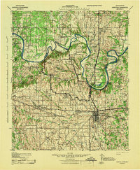
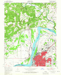
 1943 Fort Smith1943 Print · USGSFort Smith and the Arkansas River valley are shown here during the height of the Second World War as the region became a major military hub. Genealogists and researchers can locate several rural schools and churches, such as St Marys School and Pleasant Ridge Church and Cem, alongside industrial sites like the Strip Mine and Smelter.
 - 1943 Map of Red Oak
 1943 Red Oak1943 Print · USGSLatimer and Le Flore counties are captured here in the early 1940s as the railroad and timber economy shaped the Ouachita foothills. Genealogists and local historians can locate early landmarks like Baldwin Cem, Salonia Sch, and the State Sanatorium near Talihina.2 unique versions available
 - 1945 Map of Anadarko
 1945 Anadarko1945 Print · USGSCaddo and Grady counties are documented during the mid-1940s as the rail-and-river economy flourished. Genealogists can locate numerous rural community landmarks like Liberty Cem, Riverside Indian School, and Oakdale Sch.2 unique versions available
 - 1946 Map of Lawton
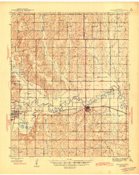
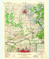
 1946 Lawton1946 Print · USGSOklahoma’s military and agricultural heritage is on full display in the mid-1940s as the city of Lawton expands south of Fort Sill. Researchers can trace rural school districts like Flower Mound Sch or locate landmarks such as the Cameron State Agricultural College.2 unique versions available
 - 1946 Map of Fort Smith
 1946 Fort Smith1946 Print · USGSThe Arkansas-Oklahoma borderlands appear here in the mid-forties, as new reservoirs began to transform the river valleys. Genealogists and historians can trace rail-served towns from Muskogee to Fort Smith and locate landmarks like Camp Chaffee.
 - 1947 Map of Van Buren, 1954 Print
 1947 Van Buren1954 Print · USGSThe riverfront cities of Fort Smith and Van Buren are shown in the late 1940s, just as the regional industrial footprint was expanding. Researchers can trace the rail lines of the Missouri Pacific or locate local landmarks like St Scholastica Academy and the Zinc Smelter.
 - 1947 Map of Greenwood, 1954 Print
 1947 Greenwood1954 Print · USGSThe Arkansas-Oklahoma border region thrived on coal and rail just after the war. Researchers can trace family ties at Old Jenny Lind and locate industrial landmarks like the Frazier Mine or the Midland Valley railroad.
 - 1947 Map of Fort Smith, 1966 Print
 1947 Fort Smith1966 Print · USGSPost-war Arkansas and Oklahoma meet at the river bend during this era of urban expansion and rail dominance. Researchers can trace the development of FORT SMITH neighborhoods and identify local landmarks like St Boniface Church and School and Twin City Hospital.4 unique versions available
 - 1947 Map of Hartford, 1969 Print
 1947 Hartford1969 Print · USGSThe Arkansas-Oklahoma borderlands come alive in this post-war survey of the coal country surrounding Hartford. Genealogists and historians can trace old mining sites marked as Coal, find rural settlements like Slaytonville, and map the rugged slopes of Sugar Loaf Mountain.3 unique versions available
 - 1948 Map of Hulbert, 1957 Print
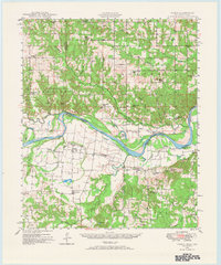
 1948 Hulbert1957 Print · USGSCherokee County at mid-century reveals a landscape of rural schoolhouses and family cemeteries just as the reservoir began to reshape the river valley. Genealogists can trace family roots through sites like Sequoyah Indian Sch, Lost City, and the Fort Gibson National Cem.3 unique versions available
 - 1948 Map of Keefeton, 1963 Print
 1948 Keefeton1963 Print · USGSMuskogee County in the late 1940s is a hub of overlapping rail lines and small rural communities just before the major shifts of the postwar era. Researchers can trace the heritage of local settlements like Rentiesville and Summit or locate family burial sites at Brushy Mtn Cem and McLain Cem.2 unique versions available
 - 1948 Map of Hackett, 1963 Print
 1948 Hackett1963 Print · USGSThe Arkansas-Oklahoma borderlands come alive in this post-war survey, documenting a landscape shaped by coal mining and ridge-top settlements. Researchers can trace the industrial footprint of strip mines near Hackett or locate family sites like Old Union Church and Mt View Cemetery.3 unique versions available
 - 1948 Map of Grant, 1963 Print
 1948 Grant1963 Print · USGSThe Red River borderlands of Oklahoma and Texas are shown here in the late 1940s, featuring the extensive Camp Maxey Military Reservation. Researchers can trace the St Louis San Francisco Railway through Grant and locate dozens of local landmarks like Hills Chapel School and Goodland Cem.2 unique versions available
 - 1948 Map of Webbers Falls, 1966 Print
 1948 Webbers Falls1966 Print · USGSThe Arkansas River valley at the close of the 1940s reveals a mix of wartime military expansion and traditional river settlements. Genealogists can locate family-named landmarks and rural institutions like South Bethel Cem, Howard Chapel, and Liberty Sch.2 unique versions available
 - 1948 Map of South Fort Smith, 1967 Print
 1948 South Fort Smith1967 Print · USGSThe borderlands of the Arkansas-Oklahoma line are captured here in the late 1940s as industry and recreation expanded beyond the city limits. Genealogists and historians can locate family landmarks such as St Scholastica Academy, Oak Cemetery, and the Dunbar School.3 unique versions available
 - 1948 Map of Wagoner, 1967 Print
 1948 Wagoner1967 Print · USGSThe river-confluence region of eastern Oklahoma is seen here just after the war, as the Fort Gibson Reservoir begins to take shape. Researchers can trace numerous rural landmarks like the Mulrow Ind Orphans Home, Tullahassee, and Blue Mound Cem.
 - 1948 Map of Direct, 1968 Print
 1948 Direct1968 Print · USGSThe Red River valley at the close of the 1940s reveals a landscape of isolated farming communities and local schools spanning the Oklahoma-Texas border. Genealogists and historians can trace the foundations of New Oberlin or locate remote landmarks like Iron Stob School and Arch Chapel Cem.
 - 1949 Map of Direct
 1949 Direct1949 Print · USGSThe Oklahoma and Texas borderlands along the Red River are captured here in the late 1940s. Local historians can trace the vanished Oberlin Ferry and old country schools like Crowder Springs School or visit family sites at Forest Grove Cem and Monkstown.2 unique versions available
Showing maps 1-25 of 38
Top cities of Oklahoma
- Oklahoma City historical maps
- Tulsa historical maps
- Norman historical maps
- Broken Arrow historical maps
- Lawton historical maps
- Edmond historical maps
See more
Top counties of Oklahoma
- Oklahoma County historical maps
- Cleveland County historical maps
- Canadian County historical maps
- Comanche County historical maps
- Rogers County historical maps
- Payne County historical maps
See more
Frequently asked questions
- What are the different types of historical maps available for Oklahoma?
- What is the oldest map of Oklahoma?
- Where can I purchase historical maps of Oklahoma for my home or office?
- Where can I download high-res historical maps of Oklahoma?
- Are there historical topographic maps available for Oklahoma?
- Is there historical aerial imagery available for Oklahoma?
- Where are historical maps of Oklahoma sourced from?