Loading...
Loading map...2022 Map of Baskerville
USGS Topo · Published 2022About this map
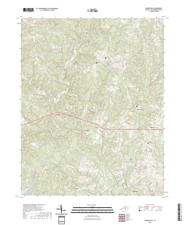
Baskerville and the surrounding Mecklenburg County landscape are defined by a network of rural routes and creek valleys that have shaped this portion of Virginia for generations. The map reveals a cluster of community nodes such as Antlers, The Ridge, and Midway, connected by the Tobacco Heritage Trl, which follows the historic path of regional commerce. These small settlements and family-named landmarks like Johnsons Pond reflect a landscape rooted in agricultural and timber history.
Find a feature on this map
67 named features on this map. Tap any name to fly to it.
Don’t see what you’re looking for? This feature index may not catch every label — zoom into the map to look around manually.
Map Details
Date Portrayed2022
Date Published2022
PublisherU.S. Geological Survey
Map TypeTopographic
Scale1:24000
Physical Dimensions24 x 29 inches
Editions of this 2022 Baskerville Map
This is the sole edition of this map. No revisions or reprints were ever made.
Historical Maps of Newmans Through Time
Featured Locations
Source Details
SourceU.S. Geological Survey
CopyrightPublic Domain