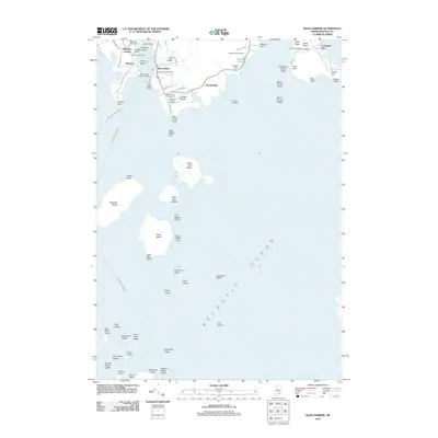
2011 Map of Bass Harbor
USGS Topo · Published 2011About this map
Bass Harbor Head anchors the southern tip of Mount Desert Island in this detailed 2011 survey, overlooking a complex maritime environment of ledges and islands. The coastal settlements of Bernard and Bass Harbor are centers of local activity, featuring infrastructure such as the Bernard Post Office, the Bass Harbor Public Landing, and Bass Harbor Marine. To the north, the small community at Baldwin Corners and the Bernard Cemetery provide points of interest for genealogists and local historians studying the area's development.
Find a feature on this map
72 named features on this map. Tap any name to fly to it.
Don’t see what you’re looking for? This feature index may not catch every label — zoom into the map to look around manually.
Map Details
Editions of this 2011 Bass Harbor Map
This is the sole edition of this map. No revisions or reprints were ever made.
Other maps of this area

1904 · Mount Desert
USGS Topo · 1:62,500

1904 · Swan Island
USGS Topo · 1:62,500

1904 · Bar Harbor
USGS Topo · 1:62,500

1942 · Bar Harbor
USGS Topo · 1:62,500

1942 · Mount Desert
USGS Topo · 1:62,500

1943 · Swans Island
USGS Topo · 1:62,500

1945 · Swans Island
USGS Topo · 1:62,500

1948 · Bangor
USGS Topo · 1:250,000

1956 · Bar Harbor
USGS Topo · 1:62,500

1956 · Mount Desert
USGS Topo · 1:62,500