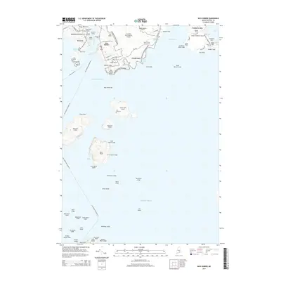
2014 Map of Bass Harbor
USGS Topo · Published 2014About this map
Acadia National Park and the rugged coastline of Mount Desert Island dominate this coastal survey of the Tremont area. The map highlights the maritime-centered landscape where Bass Harbor and Bernard serve as primary landing points, connected to the outer islands by the Swans Island Fry and Bass Harbor-Frenchboro Fry. Genealogists will find a wealth of family history in the many small burial grounds dotting the shoreline, such as the Dolliver Family Burial Ground near Wonderland and the Gott Island Cem on Great Gott Island. The geography reveals a complex network of coastal ledges and points, including Bass Harbor Head and Seawall Point, defining the maritime approach to Western Way and the Cranberry Isles. The settlement pattern follows the shore, with older road networks like Richtown Rd and Bernard Rd linking established locales like Baldwin Corners.
Find a feature on this map
90 named features on this map. Tap any name to fly to it.
Don’t see what you’re looking for? This feature index may not catch every label — zoom into the map to look around manually.
Map Details
Editions of this 2014 Bass Harbor Map
This is the sole edition of this map. No revisions or reprints were ever made.
Other maps of this area

1904 · Mount Desert
USGS Topo · 1:62,500

1904 · Swan Island
USGS Topo · 1:62,500

1904 · Bar Harbor
USGS Topo · 1:62,500

1942 · Bar Harbor
USGS Topo · 1:62,500

1942 · Mount Desert
USGS Topo · 1:62,500

1943 · Swans Island
USGS Topo · 1:62,500

1945 · Swans Island
USGS Topo · 1:62,500

1948 · Bangor
USGS Topo · 1:250,000

1956 · Bar Harbor
USGS Topo · 1:62,500

1956 · Mount Desert
USGS Topo · 1:62,500