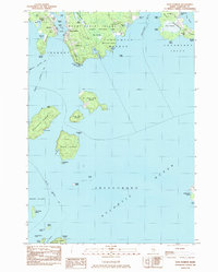
1983 Map of Bass Harbor
USGS Topo · Published 1983About this map
Mount Desert Island and the surrounding coastal waters of the Atlantic Ocean define this maritime landscape in the early 1980s. The map details the transition from the forested interior of Acadia National Park to the jagged rocky coastline of Tremont and Southwest Harbor. Significant navigation aids and landmarks are documented, including the Lighthouse at Bass Harbor Head and various ferries connecting the mainland to outlying islands.
Find a feature on this map
73 named features on this map. Tap any name to fly to it.
Don’t see what you’re looking for? This feature index may not catch every label — zoom into the map to look around manually.
Map Details
Editions of this 1983 Bass Harbor Map
This is the sole edition of this map. No revisions or reprints were ever made.
Other maps of this area

1904 · Mount Desert
USGS Topo · 1:62,500

1904 · Swan Island
USGS Topo · 1:62,500

1904 · Bar Harbor
USGS Topo · 1:62,500

1942 · Bar Harbor
USGS Topo · 1:62,500

1942 · Mount Desert
USGS Topo · 1:62,500

1943 · Swans Island
USGS Topo · 1:62,500

1945 · Swans Island
USGS Topo · 1:62,500

1948 · Bangor
USGS Topo · 1:250,000

1956 · Bar Harbor
USGS Topo · 1:62,500

1956 · Mount Desert
USGS Topo · 1:62,500