2022 Map of Bassett
USGS Topo · Published 2022About this map
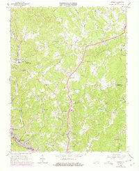
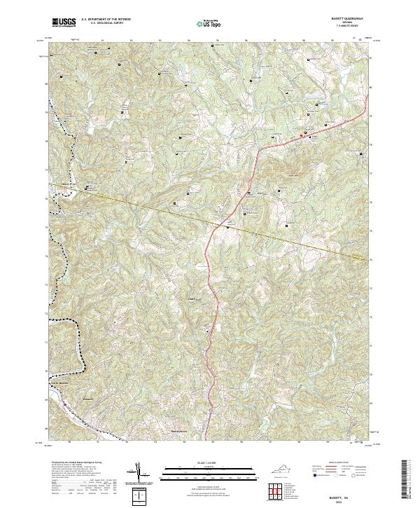
Bassett and North Bassett anchor the southern industrial corridor along the Smith River in this detailed 2022 survey of the Virginia foothills. The map reveals a landscape defined by sharp elevation changes, particularly around Skelt Mtn and the passage at Juggs Gap. This area of the Franklin-Henry County line is remarkably rich in genealogical data, preserving the locations of numerous family burial sites such as the Ferd and Walter McGhee Cem, the Ramsey Stanley King Cem, and the Gardner Ramsey Cem. These family-named landmarks are scattered across the drainage basins of Town Creek and Grassy Fork, reflecting generations of private land ownership. Settlements like Oak Level, Henry, and Stanleytown are linked by a dense network of local roads including Original Henry Rd and State Rte 604, illustrating the evolved transportation patterns of the region.
Find a feature on this map
147 named features on this map. Tap any name to fly to it.
Don’t see what you’re looking for? This feature index may not catch every label — zoom into the map to look around manually.
Map Details
Editions of this 2022 Bassett Map
This is the sole edition of this map. No revisions or reprints were ever made.