Old Maps of Henry County, Virginia
Explore 100 old maps of Henry County, spanning from 1922 to today. These high-resolution historic maps reveal how streets, neighborhoods, landmarks, and natural features evolved over time — perfect for genealogy, metal detecting, research, and local history exploration.
What you can do with these maps:
- See how Henry County changed over time: Compare historical maps to modern-day views to trace roads, homesites, rail lines & more.
- View detailed metadata: Each map includes creators, publishers, year, scale, and archive source.
- Overlay maps with satellite & LiDAR: Visualize the past alongside modern tools to explore terrain & human change.
- Trusted historical sources: Maps sourced from the USGS, Library of Congress, and other archives.
- Access maps your way: View online, download high-res files, or order prints for personal or research use.
Start exploring old maps of Henry County to uncover forgotten places, hidden landmarks, and the deep history beneath your feet.
Henry County, VA maps
(100)- 1922 Map of Callands
 1922 Callands1922 Print · USGSIn the early 1920s, this pocket of rural Virginia was a landscape of river fords, local stores, and family-named mills. Researchers can trace the roots of small communities at Callands and Swansonville or locate long-standing landmarks like Boones Chapel and La Prades Mill.
 - 1924 Map of Martinsville
 1924 Martinsville1924 Print · USGSHenry County is shown in the mid-twenties as a thriving industrial corridor along the Smith River. Genealogists can trace family roots through dozens of rural landmarks, from the Bough and Reilly Mill to the Mountain School and Rock Run Church.
 - 1924 Map of Draper
 1924 Draper1924 Print · USGSThe rural Piedmont of Southside Virginia is mapped here during the mid-twenties, showcasing a landscape of small tobacco farms and river-valley settlements. Researchers can trace family sites like Laceys Store, the Soapstone Quarry, and early depots at Leaksville Junction.
 - 1924 Map of Callands
 1924 Callands1924 Print · USGSSouthern Virginia in the early twenties shows a landscape of ridges and river bends at the borders of Franklin, Henry, and Pittsylvania counties. Researchers can trace old family sites and rural infrastructure including Swansons Mill, Burnt Chimney, and the Fralin Bridge over the Pigg River.3 unique versions available
 - 1925 Map of Rocky Mount
 1925 Rocky Mount1925 Print · USGSFranklin and Henry counties are shown in the mid-twenties, a time when life centered on the river forks and mountain gaps. Trace early industrial footprints near Bassett or locate vanished local hubs like Sydnorsville, Cassells Mill, and Snow Cr School.
 - 1926 Map of Martinsville
 1926 Martinsville1926 Print · USGSHenry County and the Virginia-North Carolina border are captured in the mid-1920s, a period when the Smith River and twin rail lines drove local industry. Researchers can locate dozens of family-named landmarks and institutions like Rough and Ready Mill, Rangeleys Store, and Horse Pasture Church.2 unique versions available
 - 1926 Map of Critz
 1926 Critz1926 Print · USGSAcross the Virginia and North Carolina border in the mid-twenties, this mountain landscape reveals a self-sufficient network of mill seats and rural post offices. Researchers can trace family ties through dozens of landmarks like Blue Mountain School, Kogers Mill, and Patrick Springs Station.2 unique versions available
 - 1926 Map of Draper
 1926 Draper1926 Print · USGSThe Virginia and North Carolina borderlands come alive in the mid-1920s, showing a landscape of small tobacco farms and rail-dependent hamlets. Genealogists can trace family roots through numerous local landmarks like Swansonville, Bachelors Hall Church, and the Danville and Western rail line.3 unique versions available
 - 1927 Map of Rocky Mount
 1927 Rocky Mount1927 Print · USGSThe upland terrain of Franklin and Henry counties is captured here in the mid-1920s, centered on the rail hub of Rocky Mount. Researchers can trace dozens of rural schoolhouses and family-tied landmarks like Cassells Mill, Waidboro PO, and Fork Mountain Church.3 unique versions available
 - 1927 Map of Martinsville, 1942 Print
 1927 Martinsville1942 Print · USGSHenry County and the Virginia-North Carolina border are captured here during the mid-twenties, when the textile and rail economy was transforming the Piedmont. Researchers can trace family sites among dozens of landmarks like Rough and Ready Mill, Fieldale, and Rock Run Church.2 unique versions available
 - 1928 Map of Critz
 1928 Critz1928 Print · USGSPatrick and Henry Counties appear here in the late twenties, showing a transition from the Blue Ridge heights to a valley economy defined by the Danville and Western rail line. Genealogists can trace early homesteads and community hubs like Penns Store, Patrick Springs Station, and Smith Chapel.3 unique versions available
 - 1944 Map of Martinsville
 1944 Martinsville1944 Print · USGSHenry County is captured in the mid-1940s as a thriving center of industry and agriculture along the Smith River. Genealogists and historians can trace family locations near dozens of rural landmarks like Rough and Ready Mill, Cedar Chappell, and the County Farm.
 - 1944 Map of Rocky Mount
 1944 Rocky Mount1944 Print · USGSFranklin County's rural heartland is meticulously detailed in the 1940s, showing the early industrial growth of Bassett and the rail-connected hub of Rocky Mount. Genealogists can trace family landmarks and community centers like Cassell Cem, Pigg River Sch, and Ramsays Store.
 - 1944 Map of Draper
 1944 Draper1944 Print · USGSThe Virginia and North Carolina borderlands come alive in the 1940s, showing the industrial and rail corridor stretching from Spray to Draper. Researchers can trace the Danville and Western Ry route through old stops like Cascade Station and discover dozens of rural community hubs like Stony Mill and Anderson Chapel.
 - 1944 Map of Callands
 1944 Callands1944 Print · USGSThe rural Virginia Piedmont comes to life in the 1940s as schools, mills, and mountain gaps define the landscape near the Pigg River. Researchers can trace ancestral home sites and community hubs like Union Hall, Giles Mill, and the Mayflower Sch.
 - 1953 Map of Winston-Salem, 1974 Print
 1953 Winston-Salem1974 Print · USGSThe North Carolina Piedmont and Virginia highlands meet in the mid-1950s, a landscape defined by the tobacco and textile hubs of the Blue Ridge foothills. Researchers can trace the rail-and-river geography connecting Winston-Salem to mountain towns like Mount Airy and Galax.2 unique versions available
 - 1953 Map of Greensboro, 1981 Print
 1953 Greensboro1981 Print · USGSThe Piedmont borderlands of North Carolina and Virginia show a landscape defined by new reservoirs and old rail lines. Trace family roots and the changing river geography through Elon College, the John H Kerr Reservoir, and South Boston.
 - 1954 Map of Greensboro
 1954 Greensboro1954 Print · USGSThe Piedmont borderlands of North Carolina and Virginia come alive in this mid-fifties study of a region defined by its rivers and rails. Researchers can trace the growing Buggs Island Lake or follow the paths of the Southern Ry and Seaboard Air Line RR through towns like Oxford and Reidsville.
 - 1955 Map of Winston-Salem
 1955 Winston-Salem1955 Print · USGSThe Central Blue Ridge and Piedmont transition are captured here in the mid-fifties, from the industrial hub of Winston-Salem to the high peaks of Southwest Virginia. Genealogists can trace family landmarks like Richmond Hill Ch, Siloam Ch, and the old rail stops along the Southern Railway.
 - 1957 Map of Endicott, 1959 Print
 1957 Endicott1959 Print · USGSFranklin and Patrick counties are captured in the late fifties as the new waters of Philpott Reservoir settle into the landscape. Trace generational landmarks like Ferrum Jr College, the County Farm, and Woods Store across the Blue Ridge foothills.2 unique versions available
 - 1962 Map of Winston-Salem
 1962 Winston-Salem1962 Print · USGSThe North Carolina Piedmont meets the Virginia highlands in the early sixties, showing the rail corridors and mountain gaps of the southern Appalachians. Researchers can trace the Blue Ridge Parkway or locate family sites near Winston-Salem, Mount Airy, and Hanging Rock Mountain.
 - 1962 Map of Greensboro
 1962 Greensboro1962 Print · USGSThe Piedmont region along the Virginia and North Carolina border comes alive in the early 1960s, showing a landscape defined by industry and new reservoirs. Trace the path of the Virginian RR or explore the early development of Greensboro and Durham.
 - 1964 Map of Snow Creek, 1966 Print
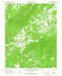 1964 Snow Creek1966 Print · USGSFranklin and Henry Counties are documented in the mid-1960s, showing a rural Virginia landscape shaped by the ridges of Fork Mountain. Genealogists can locate family names and sites like Dyers Store, Flatrock Ch, and the Wyatt Cem.4 unique versions available
 - 1964 Map of Martinsville East, 1966 Print
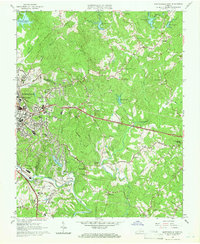 1964 Martinsville East1966 Print · USGSMartinsville and the Smith River valley appear here in the mid-sixties during a decade of regional expansion and institutional growth. Researchers can locate family-named landmarks like Barrow Cem, historic settlements such as Old Liberty, and the original Martinsville Speedway.5 unique versions available
 - 1964 Map of Spray, 1966 Print
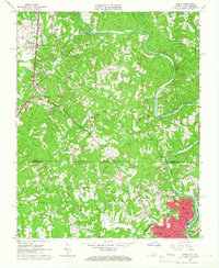 1964 Spray1966 Print · USGSThe Virginia and North Carolina border comes alive in the mid-sixties, centered on the industrial hub of the Smith River valley. Genealogists can trace family roots through numerous local landmarks like New Bethel Ch, Osborne Ch, and the streets of Leaksville.
Showing maps 1-25 of 100
Top cities of Henry County
- Collinsville historical maps
- Stanleytown historical maps
- Bassett historical maps
- Fieldale historical maps
- Oak Level historical maps
- Ridgeway historical maps
See more
Frequently asked questions
- What are the different types of historical maps available for Henry County?
- What is the oldest map of Henry County?
- Where can I purchase historical maps of Henry County for my home or office?
- Where can I download high-res historical maps of Henry County?
- Are there historical topographic maps available for Henry County?
- Is there historical aerial imagery available for Henry County?
- Where are historical maps of Henry County sourced from?