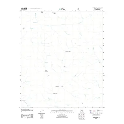
2011 Map of Bassett Peak
USGS Topo · Published 2011About this map
Hooker Cabin sits at the base of Gold Gulch in this high-elevation Graham County landscape, characterized by a complex network of canyons and peaks. The prominence of Bassett Peak anchors the southern portion of the map, while Kielberg Peak and Grassy Peak dominate the western horizon. The drainage patterns are well-defined by Rattlesnake Creek and Paddys River, illustrating the water-scarce environment where numerous named springs and tanks, such as Knothe Spring, Upper Flat Spring, and Kielberg Tank, were critical for ranching and travel.
Find a feature on this map
43 named features on this map. Tap any name to fly to it.
Don’t see what you’re looking for? This feature index may not catch every label — zoom into the map to look around manually.
Map Details
Editions of this 2011 Bassett Peak Map
This is the sole edition of this map. No revisions or reprints were ever made.
Other maps of this area

1938 · Galiuro Mts
USGS Topo · 1:48,000

1940 · Sierra Bonita Ranch
USGS Topo · 1:62,500

1942 · Sierra Bonita Ranch
USGS Topo · 1:62,500

1943 · Galiuro Mts
USGS Topo · 1:62,500

1943 · Sierra Bonita Ranch
USGS Topo · 1:62,500

1943 · Winchester Mts.
USGS Topo · 1:62,500

1945 · Redington
USGS Topo · 1:62,500

1945 · Winchester Mts.
USGS Topo · 1:62,500

1956 · Tucson
USGS Topo · 1:250,000

1957 · Redington
USGS Topo · 1:62,500