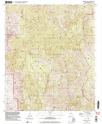
1996 Map of Bassett Peak
USGS Topo · Published 2003About this map
Galiuro Mountains dominate this landscape, where the rugged topography of the Galiuro Wilderness preserves a window into Arizona's mineral and ranching past. Evidence of early resource extraction remains at the Powers Mine and Long Tom Mine, situated in the remote drainages of the Coronado National Forest. This 1996 update, based on 1970s topographic data, records the scattered outposts of human activity including Kielberg, the Hooker Cabin, and Browning Dam. The map's detail is particularly valuable for tracing water sources in an arid environment, documenting numerous named points such as Rattlesnake Spring, Echols Spring, and Mitchell Spring. These springs and tanks supported the high-altitude cattle operations and mining claims that once defined this portion of the range near Bassett Peak.
Find a feature on this map
55 named features on this map. Tap any name to fly to it.
Don’t see what you’re looking for? This feature index may not catch every label — zoom into the map to look around manually.
Map Details
Editions of this 1996 Bassett Peak Map
This is the sole edition of this map. No revisions or reprints were ever made.
Other maps of this area

1938 · Galiuro Mts
USGS Topo · 1:48,000

1940 · Sierra Bonita Ranch
USGS Topo · 1:62,500

1942 · Sierra Bonita Ranch
USGS Topo · 1:62,500

1943 · Galiuro Mts
USGS Topo · 1:62,500

1943 · Sierra Bonita Ranch
USGS Topo · 1:62,500

1943 · Winchester Mts.
USGS Topo · 1:62,500

1945 · Redington
USGS Topo · 1:62,500

1945 · Winchester Mts.
USGS Topo · 1:62,500

1956 · Tucson
USGS Topo · 1:250,000

1957 · Redington
USGS Topo · 1:62,500