2024 Map of Batavia
USGS Topo · Published 2024About this map
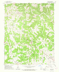
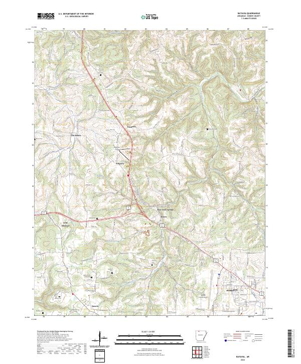
Harrison and its northwestern outskirts are revealed in this modern topographic study, showing a landscape defined by the intersection of high-country hollows and a maturing transportation network. Small settlements like Prosperity, Ridgeway, and Batavia follow the winding paths of roads such as Old Hwy 62 W and Dubuque Rd N, which cut through the Ozark terrain. The abundance of small family and community burial grounds, including the Walter Smith Family Cem and Gass Cem, indicates a deeply rooted ancestral history throughout the rural sections of Boone County. Aviation and local industry are marked by the presence of the Boone County Airport and Ridgeway Field. Waterways like Rolands Fork and Wolf Creek have carved distinct drainage patterns through the numerous named hollows, such as Kendall Hollow and Sweet Hollow, which influence the placement of homes and farmsteads.
Find a feature on this map
135 named features on this map. Tap any name to fly to it.
Don’t see what you’re looking for? This feature index may not catch every label — zoom into the map to look around manually.
Map Details
Editions of this 2024 Batavia Map
This is the sole edition of this map. No revisions or reprints were ever made.