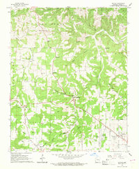
1967 Map of Batavia
USGS Topo · Published 1969About this map
Batavia and the surrounding Arkansas hills show a landscape shaped by agricultural life and early transportation networks during the late 1960s. The presence of the Old Railroad Grade and Old RR GR tracing through the terrain speaks to a previous era of transit that once connected these rural communities. Small settlements like Prosperity, Ridgeway, and Kendall are scattered across the map, often situated near natural water sources such as Bear Creek Springs and Lick Branch.
Find a feature on this map
46 named features on this map. Tap any name to fly to it.
Don’t see what you’re looking for? This feature index may not catch every label — zoom into the map to look around manually.
Map Details
Editions of this 1967 Batavia Map
This is the sole edition of this map. No revisions or reprints were ever made.
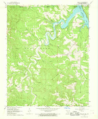
Other maps of this area

1904 · Harrison
USGS Topo · 1:125,000

1905 · Harrison
USGS Topo · 1:125,000

1945 · Harrison
USGS Topo · 1:250,000

1949 · Harrison
USGS Topo · 1:250,000

1954 · Harrison
USGS Topo · 1:250,000

1958 · Harrison
USGS Topo · 1:250,000

1964 · Harrison
USGS Topo · 1:250,000
1966 · Omaha NE
USGS Topo · 1:24,000
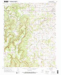
1967 · Gaither
USGS Topo · 1:24,000
1967 · Bergman
USGS Topo · 1:24,000