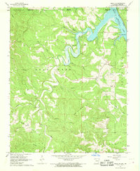
1966 Map of Omaha NE
USGS Topo · Published 1968About this map
The northern edge of Arkansas meets the Missouri border along the winding course of the White River, where the expansive Bull Shoals Lake dominates the landscape. This mid-1960s terrain is characterized by deeply incised hollows and ridges, notably White Oak Mountain and the prominent Sugarloaf formation. The map documents rural life in Boone County through small settlements like Bellville, Self, and Lead Hill, alongside institutional landmarks such as Cottonwood Cem and several community houses of worship including Dayberry Ch and Pleasant Ridge Ch. Transportation in this region is defined by the Missouri Pacific railroad corridor, which follows the natural contours of the river valleys. Local industry is represented by scattered Gravel Pits, while the development of the Tucker Hollow Recreation Area signals the area's role in regional water-based recreation following the damming of the river system.
Find a feature on this map
35 named features on this map. Tap any name to fly to it.
Don’t see what you’re looking for? This feature index may not catch every label — zoom into the map to look around manually.
Map Details
Editions of this 1966 Omaha NE Map
2 editions found
Other maps of this area

1893 · Yellville
USGS Topo · 1:125,000

1903 · Yellville
USGS Topo · 1:125,000

1904 · Harrison
USGS Topo · 1:125,000

1905 · Harrison
USGS Topo · 1:125,000

1905 · Yellville
USGS Topo · 1:125,000

1907 · Forsyth
USGS Topo · 1:125,000

1929 · Yellville
USGS Topo · 1:125,000

1943 · Protem
USGS Topo · 1:62,500

1945 · Harrison
USGS Topo · 1:250,000

1949 · Harrison
USGS Topo · 1:250,000