
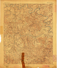
1893 Map of Yellville
USGS Topo · Published 1893About this map
The White River and Buffalo Fork carve deep, winding paths through this 1890s Ozark landscape, defining the trade and travel patterns of northern Arkansas before the era of modern bridges. Ferries are the lifeblood of the region, with numerous crossings such as Mc Bee Ferry, Denton Ferry, and Kissee Ferry punctuating the riverbanks. The settlement of Yellville serves as a central hub, surrounded by smaller communities often known by colorful dual names like Peel (Needmore), Western Grove (Gum Wad), and St Joe (Monkey Run).
Find a feature on this map
75 named features on this map. Tap any name to fly to it.
Don’t see what you’re looking for? This feature index may not catch every label — zoom into the map to look around manually.
Map Details
Editions of this 1893 Yellville Map
2 editions found
Other maps of this area

1890 · Mountain Home
USGS Topo · 1:125,000

1891 · Mountain Home
USGS Topo · 1:125,000

1892 · Marshall
USGS Topo · 1:125,000

1892 · Mountain View
USGS Topo · 1:125,000

1894 · Mountain View
USGS Topo · 1:125,000

1894 · Mountain Home
USGS Topo · 1:125,000

1894 · Marshall
USGS Topo · 1:125,000

1901 · Marshall
USGS Topo · 1:125,000

1903 · Yellville
USGS Topo · 1:125,000

1904 · Harrison
USGS Topo · 1:125,000