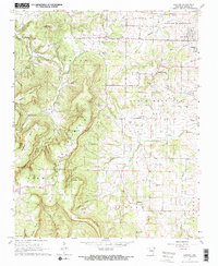
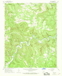
1967 Map of Gaither
USGS Topo · Published 1968About this map
Gaither Mountain dominates this portion of Boone County, its steep, finger-like ridges forming a complex network of coves and points. The high summits of Kennedy Mountain and Hembrick Knob overlook a landscape where settlement patterns follow the drainages and more accessible plateaus. Along the eastern edge, the terrain levels out near the outskirts of Harrison, while the interior remains defined by rural enclaves like Capps and Grubb Springs.
Find a feature on this map
55 named features on this map. Tap any name to fly to it.
Don’t see what you’re looking for? This feature index may not catch every label — zoom into the map to look around manually.
Map Details
Editions of this 1967 Gaither Map
2 editions found
Other maps of this area

1904 · Harrison
USGS Topo · 1:125,000

1905 · Harrison
USGS Topo · 1:125,000

1945 · Harrison
USGS Topo · 1:250,000

1949 · Harrison
USGS Topo · 1:250,000

1954 · Harrison
USGS Topo · 1:250,000

1958 · Harrison
USGS Topo · 1:250,000

1964 · Harrison
USGS Topo · 1:250,000
1967 · Bergman
USGS Topo · 1:24,000
1967 · Jasper
USGS Topo · 1:24,000
1967 · Ponca
USGS Topo · 1:24,000