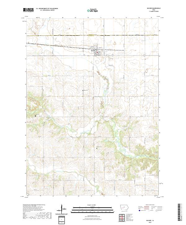
2022 Map of Bayard
USGS Topo · Published 2022About this map
The town of Bayard serves as a central hub on this West Central Iowa landscape, situated just south of the border between Greene and Guthrie Counties. The settlement pattern follows a traditional grid with streets such as Railway St and Prairie St indicating its development alongside former rail corridors. Moving south from the town center, the terrain is defined by the winding course of the Middle Raccoon River, which is joined by tributaries like Willow Cr and Brushy Cr. This area preserves several family and community landmarks essential for genealogical research, including Highland Cem, Sutton Cem, and the remote Van Ocker Cem. To the west, the landscape transitions toward recreational use with paths like White Oak Trl and Bluebell Trl navigating the river valley's contours.
Find a feature on this map
43 named features on this map. Tap any name to fly to it.
Don’t see what you’re looking for? This feature index may not catch every label — zoom into the map to look around manually.
Map Details
Editions of this 2022 Bayard Map
This is the sole edition of this map. No revisions or reprints were ever made.
Other maps of this area

1952 · Panora
USGS Topo · 1:62,500

1954 · Bagley
USGS Topo · 1:62,500

1954 · Omaha
USGS Topo · 1:250,000

1957 · Omaha
USGS Topo · 1:250,000

1958 · Omaha
USGS Topo · 1:250,000

1971 · Coon Rapids South
USGS Topo · 1:24,000

1971 · Coon Rapids NE
USGS Topo · 1:24,000

1971 · Coon Rapids North
USGS Topo · 1:24,000

1971 · Bayard
USGS Topo · 1:24,000

1971 · North Branch
USGS Topo · 1:24,000