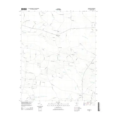
2014 Map of Bayboro
USGS Topo · Published 2014About this map
Pleasant View sits at the intersection of local routes in this portion of Horry County, serving as a focal point for the surrounding rural landscape. The area is defined by an intricate network of wetlands and drainage systems, including Pleasant Meadow Swamp and the North Prong Chinners Swamp, which dictate the placement of roads and small settlements like Playcards. Numerous family and community burial grounds, such as Graham Cem, Johnson Cem, and Strickland Cem, are scattered across the terrain, offering significant primary source data for genealogists tracking local lineages. The hydrologic pattern is particularly dense here, with named features such as Breakfast Swamp and Leather String Br weaving through the coastal plain. The map reveals how modern connectivity via SC-917 and SC-792 overlays an older pattern of dispersed homesteads and namesake ponds like Sarvis Pond.
Find a feature on this map
120 named features on this map. Tap any name to fly to it.
Don’t see what you’re looking for? This feature index may not catch every label — zoom into the map to look around manually.
Map Details
Editions of this 2014 Bayboro Map
This is the sole edition of this map. No revisions or reprints were ever made.
Other maps of this area

1937 · Nixonville
USGS Topo · 1:48,000

1942 · Nixonville
USGS Topo · 1:62,500

1943 · Adrian
USGS Topo · 1:24,000

1943 · Horry
USGS Topo · 1:24,000

1944 · Adrian
USGS Topo · 1:31,680

1948 · Galivants Ferry
USGS Topo · 1:24,000

1948 · Nichols
USGS Topo · 1:24,000

1948 · Bayboro
USGS Topo · 1:24,000

1949 · Bayboro
USGS Topo · 1:24,000

1949 · Duford
USGS Topo · 1:24,000