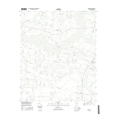
2017 Map of Bayboro
USGS Topo · Published 2017About this map
The low-lying wetlands of Horry County define the landscape around Bayboro and Playcards in this 2017 survey. The region is characterized by an intricate network of named "bays" and swamps, such as High Hill Bay, Bogue Bay, and Pleasant Meadow Swamp, which have historically dictated the patterns of local agriculture and travel. The presence of several family-named burial grounds, including Graham Cem, Johnson Cem, and Strickland Cem, provides significant value for genealogists tracing long-standing residents of this coastal plain. The infrastructure remains primarily rural, with features like Strickland Bridge crossing the expansive Playcard Swamp and numerous small tributaries such as Little Mill Br and Honey Camp Branch threading through the pine-dominated terrain.
Find a feature on this map
133 named features on this map. Tap any name to fly to it.
Don’t see what you’re looking for? This feature index may not catch every label — zoom into the map to look around manually.
Map Details
Editions of this 2017 Bayboro Map
This is the sole edition of this map. No revisions or reprints were ever made.
Other maps of this area

1937 · Nixonville
USGS Topo · 1:48,000

1942 · Nixonville
USGS Topo · 1:62,500

1943 · Adrian
USGS Topo · 1:24,000

1943 · Horry
USGS Topo · 1:24,000

1944 · Adrian
USGS Topo · 1:31,680

1948 · Galivants Ferry
USGS Topo · 1:24,000

1948 · Nichols
USGS Topo · 1:24,000

1948 · Bayboro
USGS Topo · 1:24,000

1949 · Bayboro
USGS Topo · 1:24,000

1949 · Duford
USGS Topo · 1:24,000