Loading...
Loading map...2022 Map of Bayfield
USGS Topo · Published 2022About this map
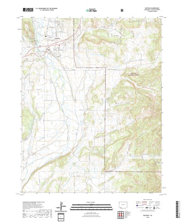
Bayfield serves as the central hub of this La Plata County landscape, where the Los Pinos River meanders through a complex network of agricultural irrigation. The town's grid is flanked by the Bayfield Cem and higher ground at Arrowhead Hill. This modern survey reveals how the local economy and geography remain deeply tied to water management, visible through named infrastructure like the Commissioner Ditch, Pine River Canal, and the Doctor Morrison Ditch.
Find a feature on this map
75 named features on this map. Tap any name to fly to it.
Don’t see what you’re looking for? This feature index may not catch every label — zoom into the map to look around manually.
Map Details
Date Portrayed2022
Date Published2022
PublisherU.S. Geological Survey
Map TypeTopographic
Scale1:24000
Physical Dimensions24 x 29 inches
Editions of this 2022 Bayfield Map
This is the sole edition of this map. No revisions or reprints were ever made.
Historical Maps of La Plata County Through Time
Featured Locations
Source Details
SourceU.S. Geological Survey
CopyrightPublic Domain