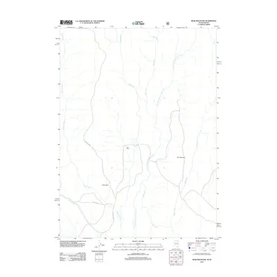
2012 Map of Bear Mountain
USGS Topo · Published 2012About this map
O'Neil Basin defines the southwestern portion of this 2012 survey, where the high-altitude terrain of Twin Falls County meets the Nevada border. This region is characterized by a network of drainage systems feeding into the North Fork Salmon Falls Creek, which carves through the landscape alongside Shell Creek and Bear Creek. The presence of Gully Ranch indicates the persistent ranching operations that have long utilized these remote grazing lands. Transportation in this corner of Idaho remains sparse, relying on primitive routes such as Oneil Basin Rd and the Nfd 300 Trl. To the east, the prominent elevation of Bear Mountain overlooks the watershed, marking a significant landmark for those navigating this high-desert mountain environment.
Find a feature on this map
11 named features on this map. Tap any name to fly to it.
Don’t see what you’re looking for? This feature index may not catch every label — zoom into the map to look around manually.
Map Details
Editions of this 2012 Bear Mountain Map
This is the sole edition of this map. No revisions or reprints were ever made.
Other maps of this area

1955 · Twin Falls
USGS Topo · 1:250,000

1955 · Wells
USGS Topo · 1:250,000

1957 · Contact
USGS Topo · 1:62,500

1957 · Elk Mountain
USGS Topo · 1:62,500

1958 · Wells
USGS Topo · 1:250,000

1958 · Twin Falls
USGS Topo · 1:250,000

1961 · Wells
USGS Topo · 1:250,000

1977 · Browns Bench South
USGS Topo · 1:24,000

1978 · Taylor Canyon
USGS Topo · 1:24,000
1980 · Curtis Draw
USGS Topo · 1:24,000