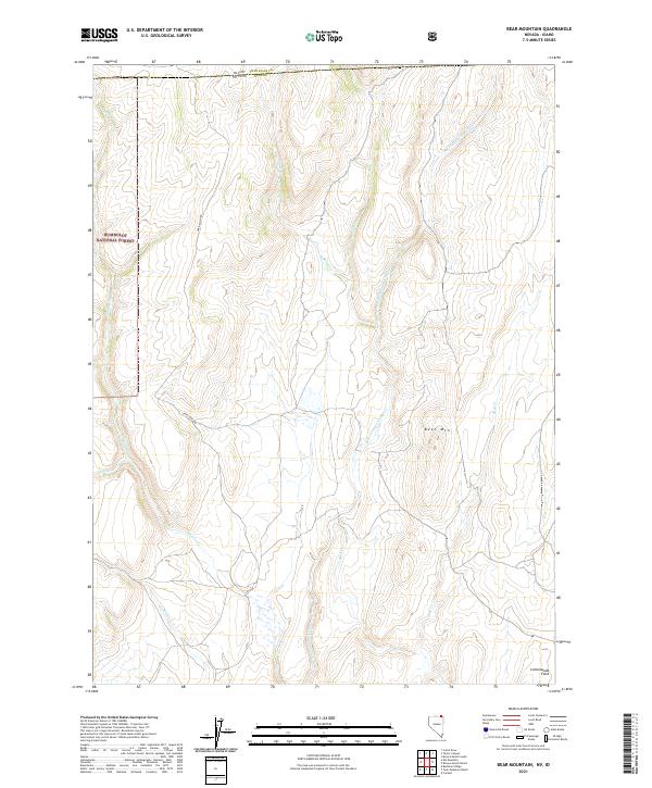
2021 Map of Bear Mountain
USGS Topo · Published 2021About this map
Humboldt National Forest dominates this high-altitude landscape where the state lines of Nevada and Idaho meet at the junction of Elko and Twin Falls counties. This remote mountainous region is defined by a complex drainage network feeding into the N Fork Salmon Falls Cr, with tributaries including Bear Cr, Shack Cr, and Shell Cr carving through the terrain. The central prominence of Bear Mtn overlooks these drainages, while the presence of Cottonwood Field in the southeast corner suggests localized land use in an otherwise wild expanse. Movement through this high-desert environment is limited to the winding path of Oneil Basin Rd, which follows the natural contours near the headwaters of Wilson Cr. This 2021 survey illustrates the modern hydrologic and topographic state of the area, preserving the names of remote watercourses like Lime Cr and Willow Cr that have served local ranchers and surveyors for generations.
Find a feature on this map
19 named features on this map. Tap any name to fly to it.
Don’t see what you’re looking for? This feature index may not catch every label — zoom into the map to look around manually.
Map Details
Editions of this 2021 Bear Mountain Map
This is the sole edition of this map. No revisions or reprints were ever made.
Other maps of this area

1955 · Twin Falls
USGS Topo · 1:250,000

1955 · Wells
USGS Topo · 1:250,000

1957 · Contact
USGS Topo · 1:62,500

1957 · Elk Mountain
USGS Topo · 1:62,500

1958 · Wells
USGS Topo · 1:250,000

1958 · Twin Falls
USGS Topo · 1:250,000

1961 · Wells
USGS Topo · 1:250,000

1977 · Browns Bench South
USGS Topo · 1:24,000

1978 · Taylor Canyon
USGS Topo · 1:24,000
1980 · Curtis Draw
USGS Topo · 1:24,000