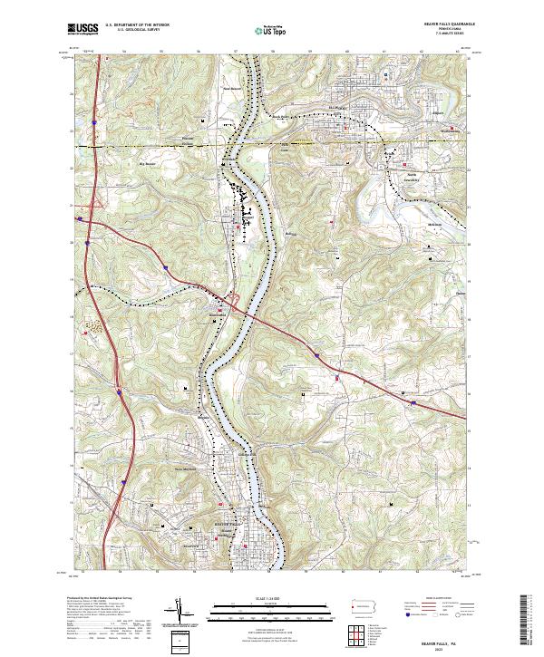
2023 Map of Beaver Falls
USGS Topo · Published 2023About this map
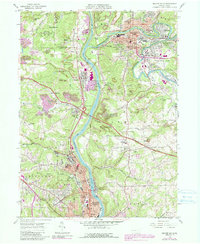
The Beaver River corridor defines the industrial and residential heart of this region, where the steep topography of the Allegheny Plateau creates a series of terraced settlements. Beaver Falls and College Hill anchor the southern portion of the sheet, characterized by the academic campus of Geneva College and the expansive Beaver Falls Cem and Mausoleum. The landscape is deeply carved by tributaries such as Connoquenessing Creek and Wallace Run, forcing development into the valley floors and along the high ridges.
Find a feature on this map
209 named features on this map. Tap any name to fly to it.
Don’t see what you’re looking for? This feature index may not catch every label — zoom into the map to look around manually.
Map Details
Editions of this 2023 Beaver Falls Map
This is the sole edition of this map. No revisions or reprints were ever made.