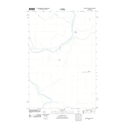
2011 Map of Beaver Pond SE
USGS Topo · Published 2011About this map
The Saint John River defines this northern landscape, winding through a remote section of Somerset County where logging infrastructure and water crossings are the primary landmarks. The terrain is marked by significant drainage systems including Burntland Brook and Knowles Brook, which feed into the river's main stem and its Southwest Branch Saint John River. Human presence is concentrated around essential transit points such as Moody Bridge and the Red Pine Grove Landing Area, indicating the region's continued importance for timber management and river access. Higher elevations are represented by Ross Mountain, which serves as a vantage point for the Ross Mountain Lookout Tower. Transport into this area relies on industrial thoroughfares like Depot Rd and Ross Mountain Rd, connecting the deep woods to more established routes.
Find a feature on this map
10 named features on this map. Tap any name to fly to it.
Don’t see what you’re looking for? This feature index may not catch every label — zoom into the map to look around manually.
Map Details
Editions of this 2011 Beaver Pond SE Map
This is the sole edition of this map. No revisions or reprints were ever made.
Other maps of this area

1954 · Baker Lake
USGS Topo · 1:62,500

1954 · Allagash Lake
USGS Topo · 1:62,500

1954 · Presque Isle
USGS Topo · 1:250,000

1955 · Beaver Pond
USGS Topo · 1:62,500

1955 · Clayton Lake
USGS Topo · 1:62,500

1958 · Presque Isle
USGS Topo · 1:250,000

1960 · Presque Isle
USGS Topo · 1:250,000

1961 · Allagash Lake
USGS Topo · 1:62,500

1962 · Baker Lake
USGS Topo · 1:62,500
1977 · Burntland Pond
USGS Topo · 1:24,000