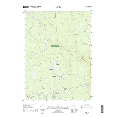
2018 Map of Becket
USGS Topo · Published 2018About this map
The Silvio O Conte National Fish and Wildlife Refuge occupies the central hills of this Berkshire County landscape, where the settlements of Becket, Washington, and Middlefield anchor the high terrain. The geography is defined by a series of prominent peaks and hollows, including Wadsworth Hill, Benton Hill, and Blush Hollow, which dictate the winding paths of rural routes like Jacobs Ladder Rd. This 2018 topography reveals a region deeply tied to seasonal recreation and conservation, evidenced by the presence of Camp Greylock, Camp Becket, and Camp Chimney Corners surrounding Rudd Pond and Center Pond. Local history is preserved at the Washington Cem and Middlefield Center Cem, while the inclusion of the small Baines Airport and numerous named brooks like Depot Brook and Walker Brook illustrate the integration of local transport and natural drainage in the Massachusetts highlands.
Find a feature on this map
151 named features on this map. Tap any name to fly to it.
Don’t see what you’re looking for? This feature index may not catch every label — zoom into the map to look around manually.
Map Details
Editions of this 2018 Becket Map
This is the sole edition of this map. No revisions or reprints were ever made.
Other maps of this area

1886 · Chesterfield
USGS Topo · 1:62,500

1886 · Becket
USGS Topo · 1:62,500

1887 · Granville
USGS Topo · 1:62,500

1888 · Becket
USGS Topo · 1:62,500

1888 · Sandisfield
USGS Topo · 1:62,500

1888 · Chesterfield
USGS Topo · 1:62,500

1889 · Granville
USGS Topo · 1:62,500

1893 · Granville
USGS Topo · 1:62,500

1893 · Chesterfield
USGS Topo · 1:62,500

1893 · Becket
USGS Topo · 1:62,500